
About Port St. Joe
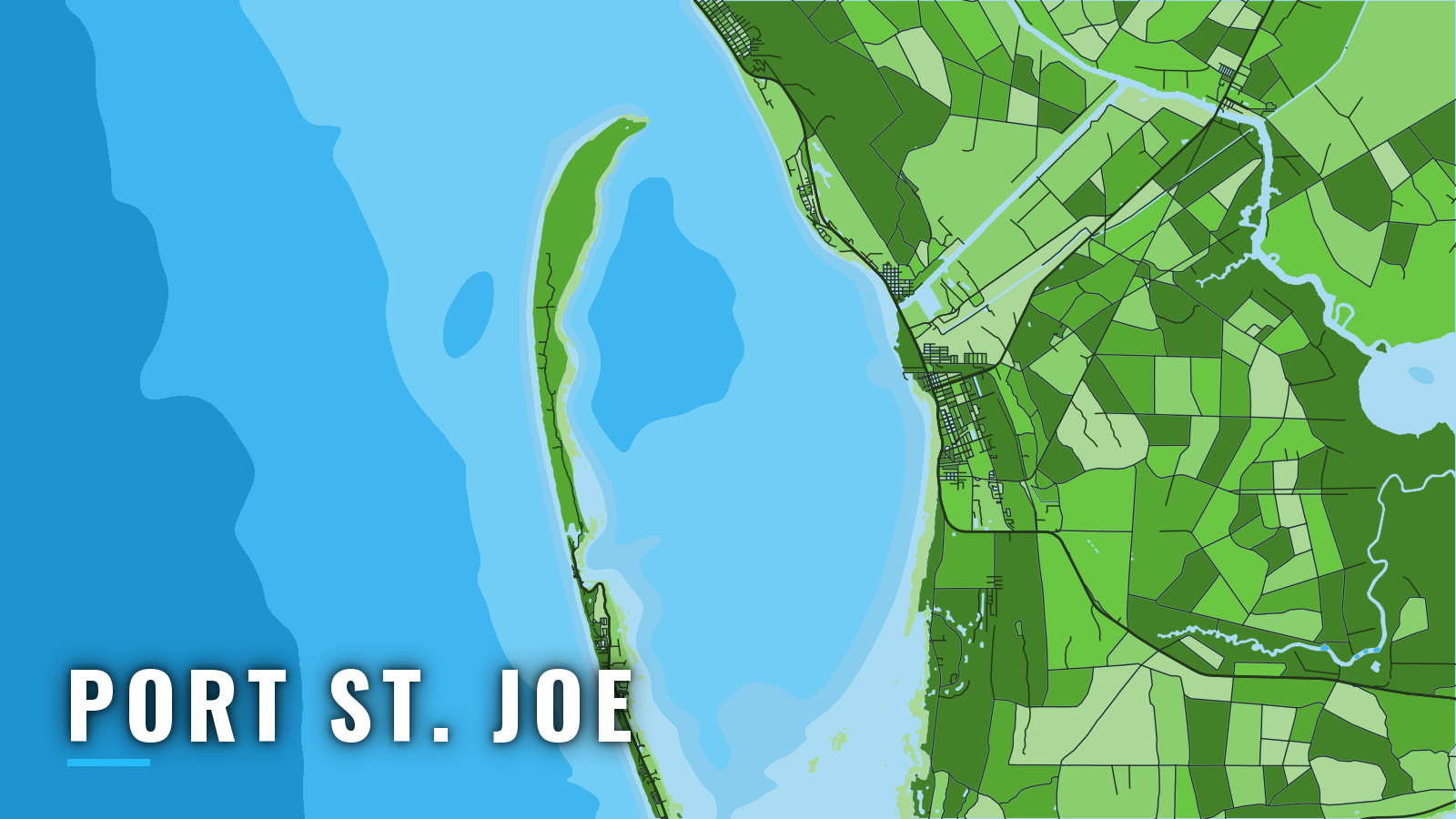
Port St. Joe offshore fishing starts on the east shore of St. Joseph Bay, which opens to the Gulf through a narrow opening at its north end. Cape San Blas lies on the peninsula that forms the bay’s west side. Offshore boats run north up the bay and out through the entrance to nearshore reefs and wrecks.
Offshore fishing runs year-round, and the species mix shifts with the seasons. Red snapper, gag grouper, scamp, amberjack, king mackerel, cobia and mahi-mahi are the main targets.
Florida FWC sets the rules for the fish you keep. Check current regulations on our Florida fishing rules page before you fish.
Access and navigation
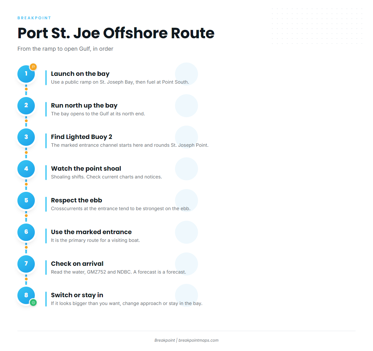
Launch at a public ramp around St. Joseph Bay, then run north up the bay to the marked entrance channel at St. Joseph Point.
Ramps and marinas:
- Frank Pate Park – City of Port St. Joe park with a public boat ramp on the bay
- Highland View Park & Boat Ramp – public boat ramp on St. Joseph Bay
- Eagle Harbor ramp, T.H. Stone Memorial St. Joseph Peninsula State Park – ramp inside the state park on the peninsula side of the bay
- Point South Marina at Port St. Joe – marina in Port St. Joe, fuel listed
- Presnell’s Bayside Marina & RV Resort – bayside marina and RV resort
Point South is the listed fuel stop, so plan your range from there.
The run up the bay and the entrance channel
The route from the Gulf into the bay follows a dredged channel, described in U.S. Coast Pilot 5, Chapter 6. It crosses 18-foot shoals and rounds St. Joseph Point, then turns south and southeast to the turning basin at Port St. Joe. Lighted ranges and lighted and unlighted buoys mark it, starting at Entrance Lighted Buoy 2.
A shoal tends to build east from the point into the west side of the channel. An obstruction with 28 feet over it and a rock with 29 feet over it lie between Lighted Buoy 17 and Buoy 18. Shoaling shifts, so the channel on an old chart may not match what you find. Check current charts and notices before you run it.
Strong, erratic crosscurrents are reported at the entrance northeast of St. Joseph Point, strongest on the ebb. An outgoing tide that sets across the channel can push a boat toward the edge where the shoal builds, and when the wind opposes the ebb, it can stack up a steeper chop.
Cape San Blas shoals
Shoals of 13 feet or less extend 4 miles south of Cape San Blas. Depths of 22 to 28 feet are found 10 miles south and southwest of the cape. In a fresh breeze from any quarter between east and northwest through south, breaking seas may run far offshore from the cape. A south-quarter breeze pushes Gulf swell onto miles of shallow bottom, where it can stand up and break well off the beach. Fog is frequent off the cape from December through March.
Approaches, in order
- The marked entrance is the primary route for a visiting boat.
- The swash channel, marked by two buoys about 2 miles south of the cape, crosses the shoals and is used by local craft on a smooth sea. It crosses the same shallow ground that can break in a fresh breeze, so treat it as a smooth-day option only.
- Indian Pass is a narrow, shifting, unmarked, shallow channel into St. Vincent Sound, used by local fishing vessels. Visitors should not use it.
- Staying inside St. Joseph Bay is the fallback.
Check on arrival
Look at the water when you get to the ramp. Then read the NWS Tallahassee GMZ752 forecast, which covers coastal waters from Mexico Beach to Apalachicola out 20 NM, and check NDBC observations near Cape San Blas. If the water looks bigger than the forecast suggested, switch approaches or stay in the bay.
Fishing conditions
Offshore grounds off Port St. Joe include charted fish havens and a set of named Gulf County reefs and wrecks. The fish havens sit in and beside the Port St. Joe Safety Fairway. The named grounds are Twin Ridges (NE, SE, NW and SW sites), Empire Mica, LST Port St Joe, Gatewood Barge, Jaycee Reef 1, C of C Reef, Virginia Reef 1 and Pompano Point. The reefs and wrecks hold bottom fish such as red grouper. You can view these grounds against Chart Contours in the app. Chart layers are not for navigation.
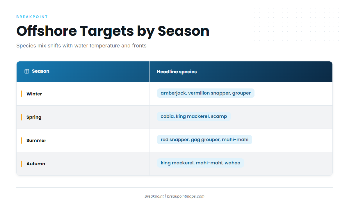
The seasons follow water temperature and the passage of fronts.
| Season | Headline species | Weather to plan around |
|---|---|---|
| Winter | Amberjack, vermilion snapper, red grouper, triggerfish | Cold fronts and fog |
| Spring | Cobia, king mackerel, scamp, grouper | Warming water, migratory runs |
| Summer | Red snapper, gag grouper, mahi-mahi, wahoo | Afternoon thunderstorms |
| Autumn | King mackerel, mahi-mahi, amberjack, scamp | First fronts, hurricane season |
Winter
Winter is shaped by cold fronts and fog. The Coast Pilot reports 15 to 20 frontal systems each winter along this coast, with strong north winds behind them. Waves of 8 feet or more are met 5 to 11 percent of the time on open water, most often in January and February.
Offshore, the list includes amberjack, vermilion snapper, red grouper, triggerfish, yellowfin tuna and swordfish. Fishable days tend to fall between fronts, so read the GMZ752 forecast before you commit to the run.
Spring
Warming water brings migratory fish along the coast. Cobia and king mackerel move through, while scamp, red grouper and black grouper hold on the bottom. Amberjack, blackfin tuna and yellowfin tuna are in the mix, and blue and white marlin show up for boats that run out to bluewater.
Summer
Red snapper is the main summer target. The red snapper season is set by the agency and changes, so check FWC through the Florida page before you fish. Gag grouper is on the bottom, and mahi-mahi show up in the bluewater. Wahoo, yellowfin and blackfin tuna, and blue and white marlin round out the offshore list.
Afternoon thunderstorms tend to build over land and move offshore. Hurricane season covers the summer and autumn months. Watch the GMZ752 forecast and the sky.
Autumn
Cooling water and the first fronts bring the kings back. The returning kings are joined by mahi-mahi offshore. Amberjack, scamp, wahoo, sailfish, yellowfin and blackfin tuna, and swordfish are also on the autumn list.
Fronts start to reach the coast again as the season turns.