
About Grand Isle
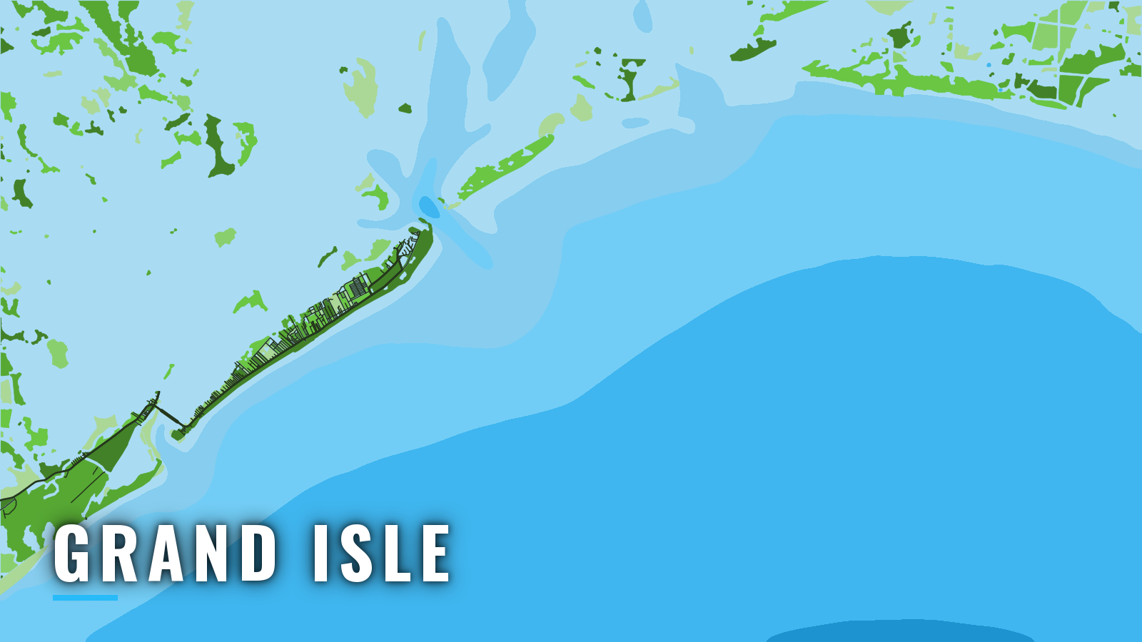
Grand Isle sits on a long, narrow barrier island at the mouth of Barataria Bay, between Barataria Pass to the east and Caminada Pass to the west. It is the only town on the bay, and both passes open onto the Gulf of Mexico. Oil and gas platforms and artificial reef structure lie south of the passes, and the port fishes year-round.
Anglers target yellowfin tuna, blackfin tuna, mahi-mahi and wahoo here, along with red snapper, cobia and greater amberjack. Before you fish, check the Louisiana fishing rules and the LDWF recreational saltwater regulations. Offshore species require the free Recreational Offshore Landing Permit (ROLP). Red snapper landings are reported through LA Creel, and LDWF opens and closes the season as landings approach the state allocation. The sections below cover where to launch and fuel, how the passes tend to behave, then the grounds and the seasons.
Access and navigation
Ramp, fuel and slip status can change after storms, so call ahead before you tow.
- Bridge Side Marina – fuel and slips.
- Hurricane Hole Marina – fuel and slips, plus published approach waypoints for coming in from Caminada Pass.
- Sand Dollar Marina – boat launch.
Bayou Rigaud channel. A dredged channel leads southwest from just inside Barataria Pass for about 3.7 miles through Bayou Rigaud to town. Lights, buoys and daybeacons mark it. The entrance is reported to be subject to shoaling, so stay in the marked channel and watch your sounder near the entrance.
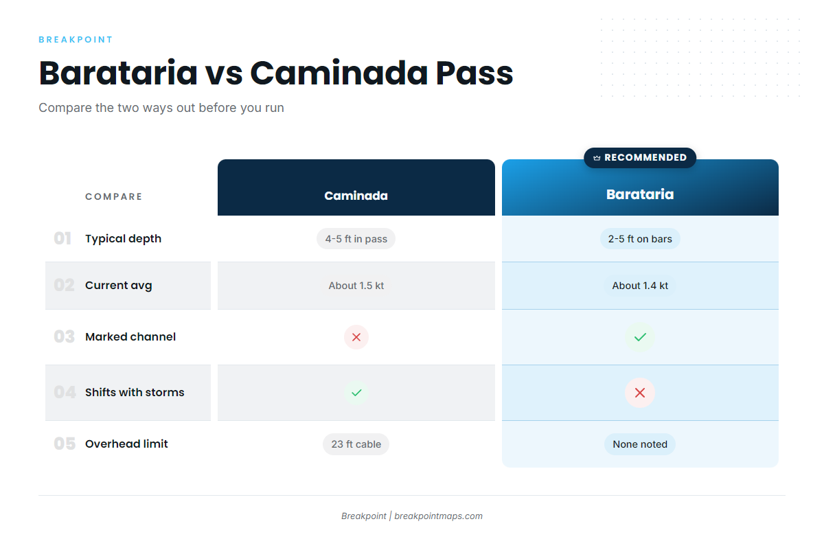
Barataria Pass. This is the main entrance. Per the NOAA Coast Pilot 5 chapter, a jetty runs southeast from the east tip of the island. A lighted whistle buoy about 3 miles southeast of the jetty end marks the approach to the dredged channel across the bar. Hard sandbars with 2 to 5 feet over them extend about 1 mile on each side of the channel, and the bar can show in extremely heavy winds. Tidal current averages about 1.4 knots.
Wind against tide is what usually changes the pass. A 1.4-knot ebb against a southeast wind can stand the water up over the bar. With hard shoals on both sides there is little room off the channel, so run the buoyed line out to the whistle buoy. Commercial vessels also use the pass.
Caminada Pass, the alternative. It lies about 7 miles southwest of Barataria Bay, under the LA-1 bridge. The entrance channel shifts with storms, and charted depths may not match the water afterward. Depths are usually 4 to 5 feet into the pass and 2 to 3 feet into Caminada Bay. Current averages about 1.5 knots, with higher speeds reported, and wrecks lie nearby.
The fixed bridge has 47 feet of clearance. The overhead power cable has 23 feet, and that cable sets the limit. It can rule out some towers, antennas and outriggers, so measure your air draft before choosing this route. The shallow depths suit shallow-draft hulls, and deeper boats tend to stay with Barataria. Use the Hurricane Hole waypoints as a starting reference for the approach.
Before you commit. Look at the water and read the official NWS marine forecast on arrival. Compare wind, wave height and period with what you see, and read observed conditions at NDBC station GISL1 (8761724). Forecasts can be wrong. If the pass looks bigger than you want, switch approaches, and if neither suits you, wait.
Fishing conditions
Grand Isle offshore fishing centers on structure: platforms, reefs and banks south of the passes, with deeper edges beyond. Anglers work Grand Isle’s offshore hotspots by name:
- Grand Isle 9. The Freeport sulphur reef, a former sulphur structure donated as an artificial reef, now submerged about 30 feet down.
- Sandy Point rigs. West Delta platforms worked for snapper and pelagics.
- Exxon-Mobil platforms. Southwest of Barataria Pass.
- Midnight Lump. A bank at Sackett Bank.
In deeper water, anglers work the Mississippi Canyon and Green Canyon edges and the Ewing Bank platforms for yellowfin tuna and blue marlin. Offshore oil and gas structures extend up to 125 miles out, and some may be unlit, which is a hazard on night runs.
The Mississippi River plume and the blue-water line tend to shift where bait and pelagics gather. Rigs also come and go with decommissioning, so a platform on an old chart may be gone. The OBS SST, Chlorophyll and Chart Contours layers in Breakpoint help you read the plume edge and the blue-water line. Chart layers are not for navigation.
Winter
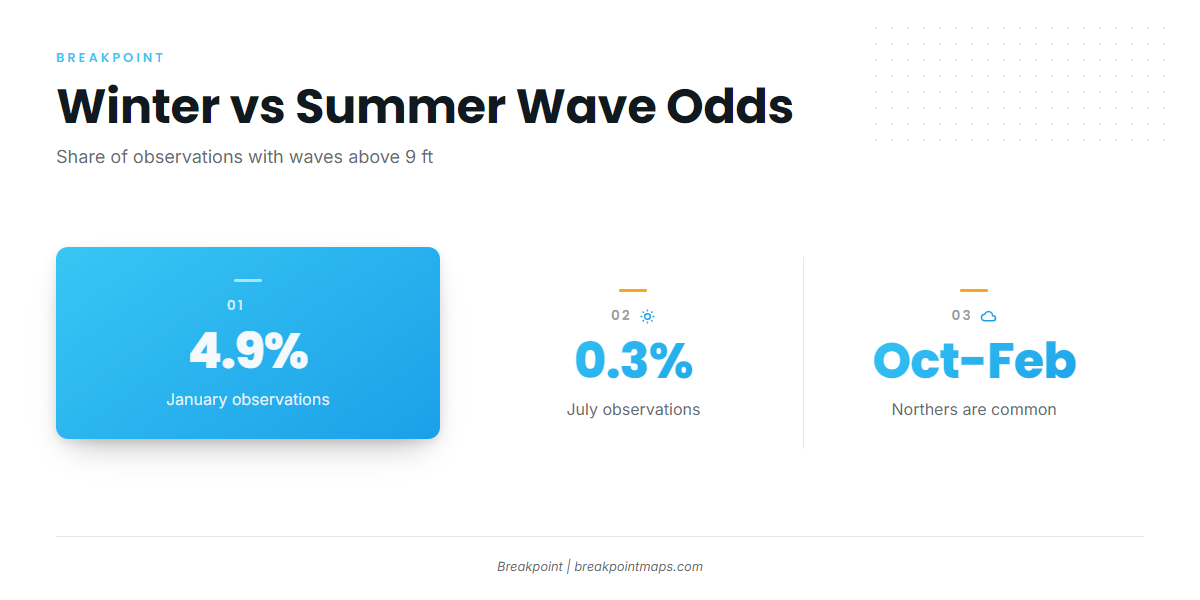
Northers are common from October through February. In the coastal area off New Orleans, waves above 9 feet occur in about 4.9% of January observations, and fog is more likely. Winter tends to be when anglers look for larger yellowfin, and it brings the wahoo run. Blackfin tuna are the cold-season tuna option around the rigs. Windows between fronts can be short, so plan around the forecast.
Spring
Fog remains more likely in early spring. Cobia tend to show around reefs and rigs from spring into summer, and anglers target them on the structure south of the passes.
Summer
Waves above 9 feet drop to about 0.3% of July observations, the lowest of the year. Summer is also hurricane season, so watch the tropics. Mahi-mahi tend to peak around floating debris and weedlines. Red snapper falls under the state-managed season tracked through LA Creel, so check LDWF for the current status before you go.
Autumn
Northers return from October. Yellowfin and cobia remain targets around the rigs. Greater amberjack opens on a quota-driven season, so check LDWF before you fish.