
About Carolina Beach
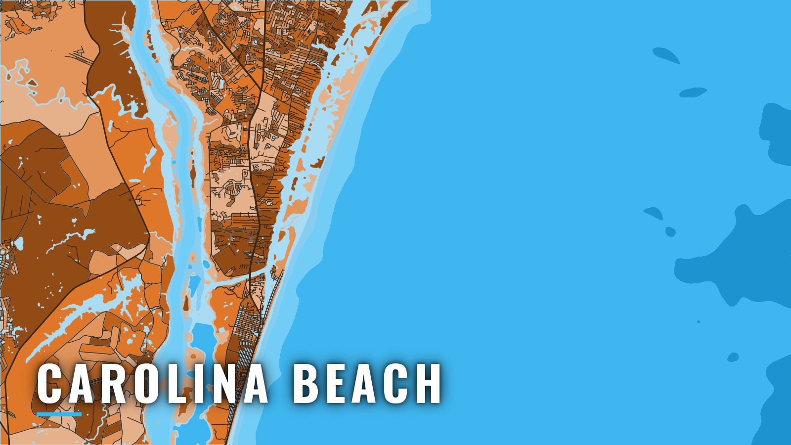
Carolina Beach sits on the sound side of Pleasure Island. Boats reach the ocean through Carolina Beach Inlet, about 3 miles north of town, or through Snows Cut to the Cape Fear River. Day trips work the nearshore reefs, and longer runs go to the Gulf Stream. Fishing runs year-round, and the bluewater peak tends to fall in the warm months. Most anglers come for king mackerel, Spanish mackerel, mahi, wahoo, sailfish, cobia, grouper, black sea bass and tunas. The town is one of the North Carolina ports we cover.
Access and navigation
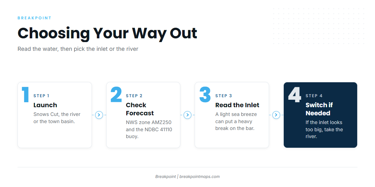
Carolina Beach has public launches on Snows Cut and the river, plus the town basin:
- Carolina Beach State Park boat ramp – at the junction of Snows Cut and the Cape Fear River.
- Carolina Beach State Park Marina – 54 slips, with fuel and fishing supplies at the marina store.
- Snows Cut Boating Access Area – NC Wildlife Resources Commission ramp on Snows Cut.
- Fort Fisher Boating Access Area – NC Wildlife Resources Commission ramp on the river side. The route out runs down the Cape Fear River to its entrance.
- Carolina Beach Municipal Marina and Mooring Field – the town basin, connected to Myrtle Grove Sound and the Intracoastal Waterway by a daybeacon-marked channel.
The inlet. Carolina Beach Inlet is about 7 miles south of Masonboro Inlet and about 3 miles north of town. A lighted whistle buoy marks the approach, and the buoys in the inlet are unlighted. The NOAA Coast Pilot 4 describes the inlet as subject to continual change and says it requires local knowledge, so buoys may not sit where your chart shows them. A light sea breeze can put a heavy break on the bar, while a land breeze of the same strength often won’t. Breakers tend to show on the shoals first, and the Coast Pilot names the look of the water as the best guide.
The Cape Fear River route. Run Snows Cut west to the river, then down the ship channel and out the Cape Fear River entrance below Southport. The Coast Pilot puts the Intracoastal Waterway’s junction with the ship channel about 11.5 miles above the river mouth. Currents on the bar tend to run hard and mostly along the channel. On the last of the flood and the first of the ebb they can set east across it, and at the start of the flood they can set west. The approaches carry a traffic separation scheme and a precautionary area, and the Coast Pilot advises against anchoring or lingering there because of heavy ship traffic. Sea fog is likely from November through April with south or southeast winds. It can hang on for days until a west wind clears it, and it can be thick on the bar while the river is clear a few miles up. Logs and debris can show after heavy rain or unusually high tides.
Reading conditions. Check these before choosing a way out:
- NWS Wilmington marine forecast, zone AMZ250 (Surf City to Cape Fear, out 20 nm).
- NDBC station 41110, the waverider buoy off Masonboro Inlet, the next inlet north of Wrightsville Beach. Read wave height and period there. The forecast covers a zone, while the buoy reports a single spot.
- Orton Point tidal currents, station 8658501, to see when the river turns, which matters for the bar sets above.
Look at the water and the AMZ250 forecast when you arrive. If the inlet looks bigger than you want, take the river.
Fishing conditions
Off Carolina Beach, the reefs inside 11 nm handle most day trips, and the Gulf Stream is the long run. For regional context, see our Atlantic Southeast fishing guide. The OBS SST and Chlorophyll layers in Breakpoint show where temperature breaks and color edges sit before you commit fuel to the run, and Chart Contours help you find ledge and reef depths. Chart layers are not for navigation.
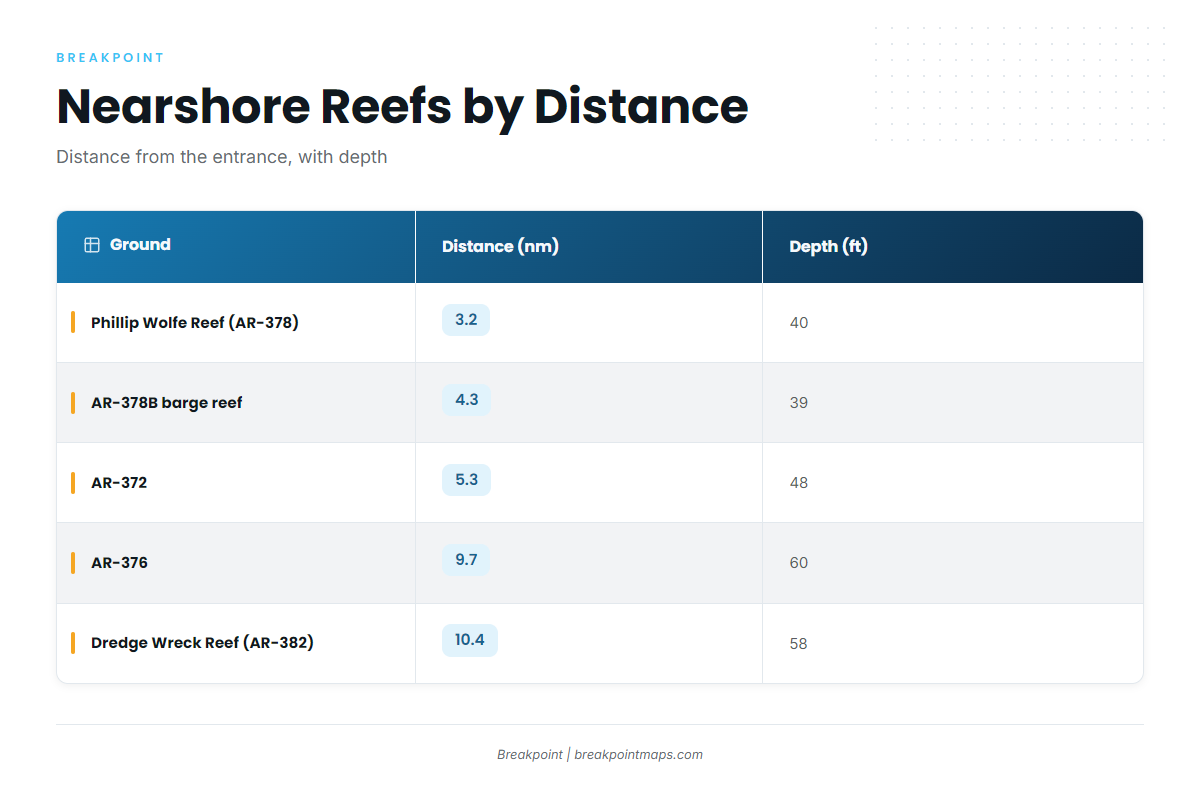
The named grounds below come from the NCDMF Artificial Reef Guide. Distances are from the entrance.
| Ground | Type | Distance (nm) | Depth (ft) |
|---|---|---|---|
| Phillip Wolfe Reef (AR-378) | reef | 3.2 | 40 |
| AR-378B | barge reef | 4.3 | 39 |
| AR-372 | reef | 5.3 | 48 |
| AR-376 | reef | 9.7 | 60 |
| Dredge Wreck Reef (AR-382) | wreck | 10.4 | 58 |
| Meares Harris Reef (Liberty Ship) | reef | · | 50 |
| 5-Mile Boxcar reef | reef | · | · |
| 10-Mile Boxcar reef | reef | · | · |
| The Steeples | bottom | · | · |
Past the reefs, the Gulf Stream is the bluewater run for mahi, wahoo, tunas and billfish.
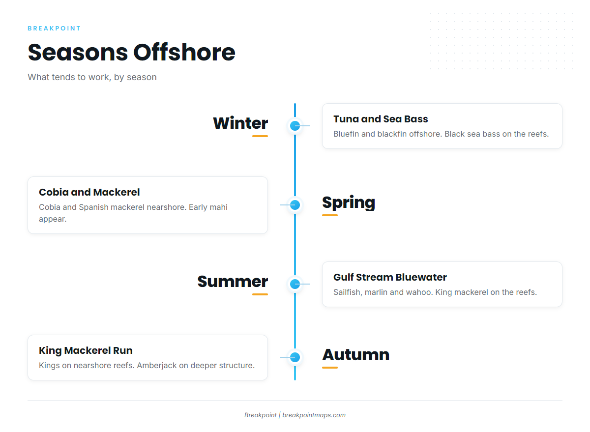
Winter
Bluefin and blackfin tuna tend to be Gulf Stream and offshore fish, while black sea bass work the reefs and live bottom. Wahoo can show too, and our wahoo fishing guide covers how to find them. Weather windows tend to be narrow. If you plan the river route, keep the November to April sea fog on the Cape Fear bar in mind.
Spring
Cobia and Spanish mackerel tend to show nearshore and on the reefs. Yellowfin and blackfin tuna are offshore, and gag and black grouper are on bottom. Gag and red snapper seasons change by quota and announcement, so check NCDMF and NOAA Fisheries red snapper announcements before you drop. Early mahi start to show, and our mahi-mahi fishing guide has the detail.
Summer
Sailfish, blue and white marlin, and wahoo tend to be Gulf Stream fish. Mahi are the main bluewater target, and mahi-mahi in the Atlantic Southeast covers the regional pattern. King mackerel tend to work the nearshore reefs, and our king mackerel fishing guide goes deeper.
Autumn
The fall run tends to put king mackerel on the nearshore reefs, and king mackerel in the Atlantic Southeast covers the regional picture. Wahoo are back in the mix, with wahoo in the Atlantic Southeast as the reference. Greater amberjack are on deeper structure, yellowfin are offshore, and bluefin tend to arrive late in the season.
Size, bag and season rules for North Carolina waters are on our North Carolina page. Check NCDMF size and bag limits before you fish.