
About Newport
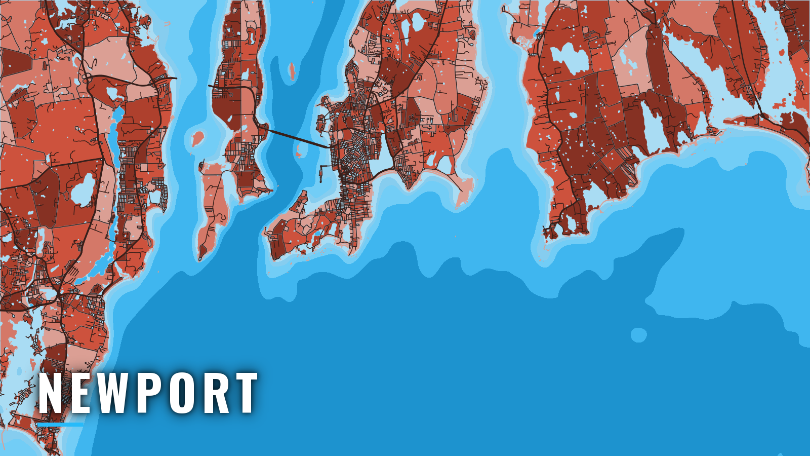
Newport, RI offshore fishing starts on the east side of Narragansett Bay’s East Passage, 3.5 miles above Beavertail Light, with Rhode Island Sound to the south. That puts you at the edge of Atlantic Northeast waters, with the shelf beyond the Sound within reach of a capable boat. The season runs spring through autumn, and winter is thin. You fish striped bass and tautog in and near the bay, and bluefin tuna and yellowfin tuna on nearshore grounds in summer and early fall. RIDEM sets size, bag and season rules in state waters; they are on our Rhode Island page, and you should check them before you fish.
Access and navigation
Newport has a state ramp and a harbor marina with fuel. Several approaches lead out of the harbor, and conditions at the bay mouth can change which one you choose.
Ramps and marinas
- Fort Adams State Park boat rampstate-owned public ramp off Harriston Ave., listed at 3 ft at mean low water.
- Goat Island Marinaslips and fuel inside the harbor.
The city harbormaster runs transient moorings on a first-come, first-served basis. See the Newport transient mooring rules before you plan a stay.
Getting out
There are three routes: the Narragansett Bay entrance and East Passage, the outer harbor’s southern approach, and the inner harbor entrances north and south of Goat Island.
Strong wind against the current at the mouth of the bay tends to stand the water up and steepen it. Off Bull Point, the ebb is regular and averages 1.5 knots at strength. The flood reaches about 1.2 knots there and is often irregular, sometimes with a long slack or a double flood. A south or southwest wind over a running ebb might make the mouth look bigger than the forecast suggests. The numbers come from the Coast Pilot’s Narragansett Bay chapter.
Hazards near the entrance
- Brenton Reef: bare in places, extends 0.5 mile south-southwestward of Brenton Point and is marked by a gong buoy. Seas can stack on it.
- Seal Ledge: depths of 15 to 30 feet.
- Haycock Ledge: least depth of 12 feet.
- Butter Ball Rock: uncovers 1 foot, 0.2 mile south of Castle Hill Light.
- Harbor traffic: moored boats and traffic can slow the run in and out.
Traffic separation scheme and restricted areas
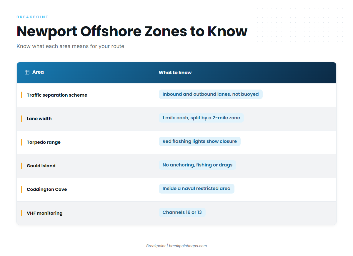
The Narragansett Bay approach has one-way inbound and outbound lanes, each 1 mile wide and about 11.5 miles long, split by a 2-mile-wide zone. The scheme is not buoyed. Use caution in and around the lanes and monitor VHF 16 or 13.
A 2-mile-wide Navy torpedo range restricted area lies north of the separation zone, out to 41°24.7’N. It can be closed in daylight and good weather, and closure is shown by red flashing lights on naval vessels.
A naval restricted area also surrounds Gould Island and extends north between Conanicut and Prudence Islands. Anchoring, fishing and towing a drag are barred there because of a cable system. Coddington Cove is inside a naval restricted area too.
Alternative approaches
The inner harbor entrance north of Goat Island and the southern outer-harbor approach can suit different conditions. Which one is better tends to depend on wind, tide and where the swell is running.
From the east, the Coast Pilot approach passes well south of Seal Ledge and Brenton Reef and keeps Castle Hill Light bearing east of 003°. If the East Passage mouth looks bigger than you want, the West Passage past Beavertail might be an option. If you cut across inside the bay, remember the Gould Island restriction.
Before you leave the dock
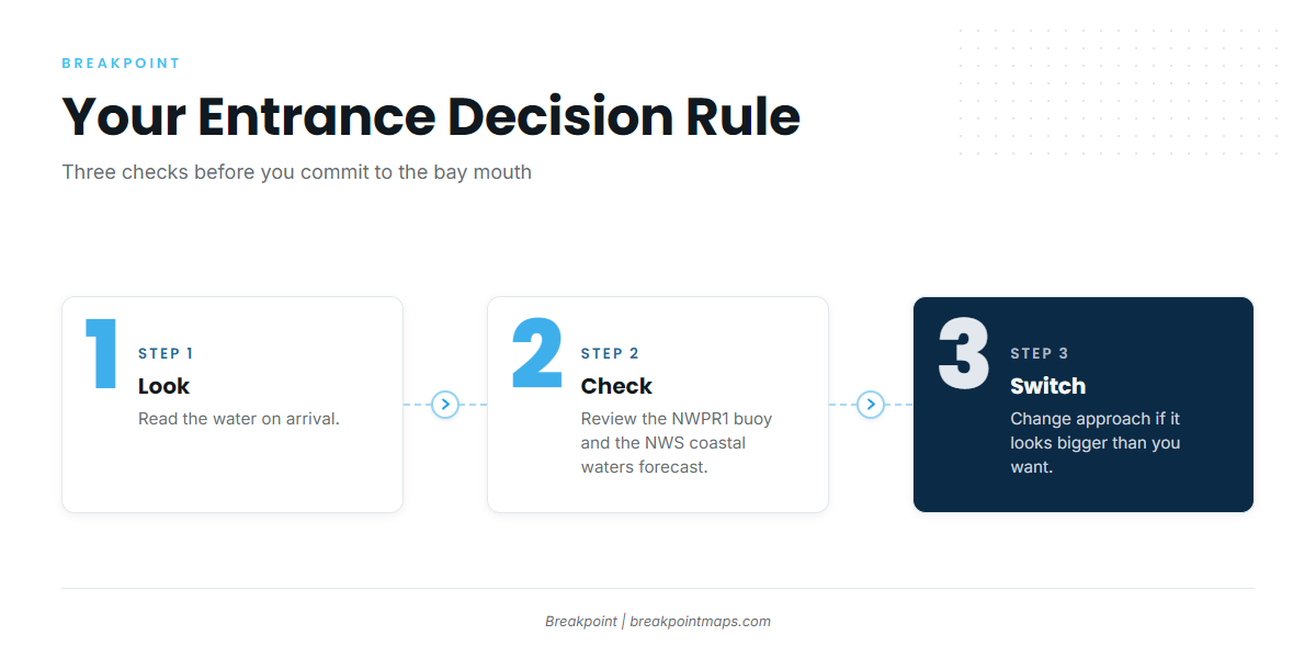
- Look at the water when you arrive.
- Check the NDBC NWPR1 buoy and the NWS Boston/Norton coastal waters forecast for the Narragansett Bay and Rhode Island Sound zones.
- Switch approaches if it looks bigger than you want.
NWPR1 reads conditions at Newport, not at Brenton Reef, so treat it as an approximation of what you’ll find at the entrance.
Fishing conditions
Brenton Reef, Castle Hill and the Beavertail Point rock clusters and ledges tend to hold striped bass and tautog close to the entrance. Seal Rock Ledge, Great Ledge, Ohio Ledge and Sakonnet Point round out the named grounds you can work without a long run.
Farther offshore, Cox Ledge and the canyons are the grounds you run to. The shelf edge and canyons are also where bigeye tuna live. Bottom fishermen can target black sea bass over the harder structure.
Tunas, billfish, swordfish and sharks need a federal Atlantic HMS permit. For everything else, see the Rhode Island licensing rules.
| Ground | Type | What it tends to hold |
|---|---|---|
| Brenton Reef | Reef | Striped bass, tautog |
| Castle Hill | Point | Striped bass, tautog |
| Beavertail Point rock clusters and ledges | Rock | Striped bass, tautog |
| Seal Rock Ledge, Great Ledge, Ohio Ledge | Ledge | Bottom species, structure fish |
| Sakonnet Point | Point | Striped bass |
Winter
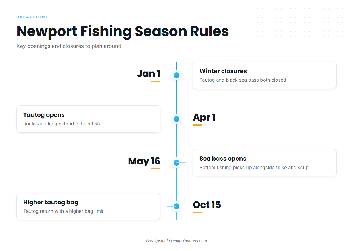
Winter is thin. Tautog are closed January 1 through March 31, and black sea bass are closed January 1 through May 15. Cod cannot be kept recreationally in state waters. Check the regulations page before you plan any trip, and expect few fish and short windows.
Spring
Tautog can show on the rocks and ledges once the season opens April 1. Check the regulations page for limits. Striped bass tend to show around Brenton Reef, Castle Hill and Beavertail as the water warms.
Summer
Striped bass continue. Fluke, black sea bass and scup can work the bottom, and black sea bass open May 16. Nearshore bluefin and yellowfin might arrive, so read up on nearshore bluefin timing. Farther out, the canyons can bring warm-water species, covered in canyon bigeye in the Northeast.
To read the water before a tuna run, our OBS SST and Chlorophyll layers show temperature breaks and color changes in one place. Chart layers are not for navigation.
Autumn
Tautog return, with a higher bag from October 15. The regulations page has the figures. Striped bass and the tunas tend to continue, and late-season yellowfin can stay in range into the fall. False albacore and bonito can push in around the ledges and points.