
About Charleston
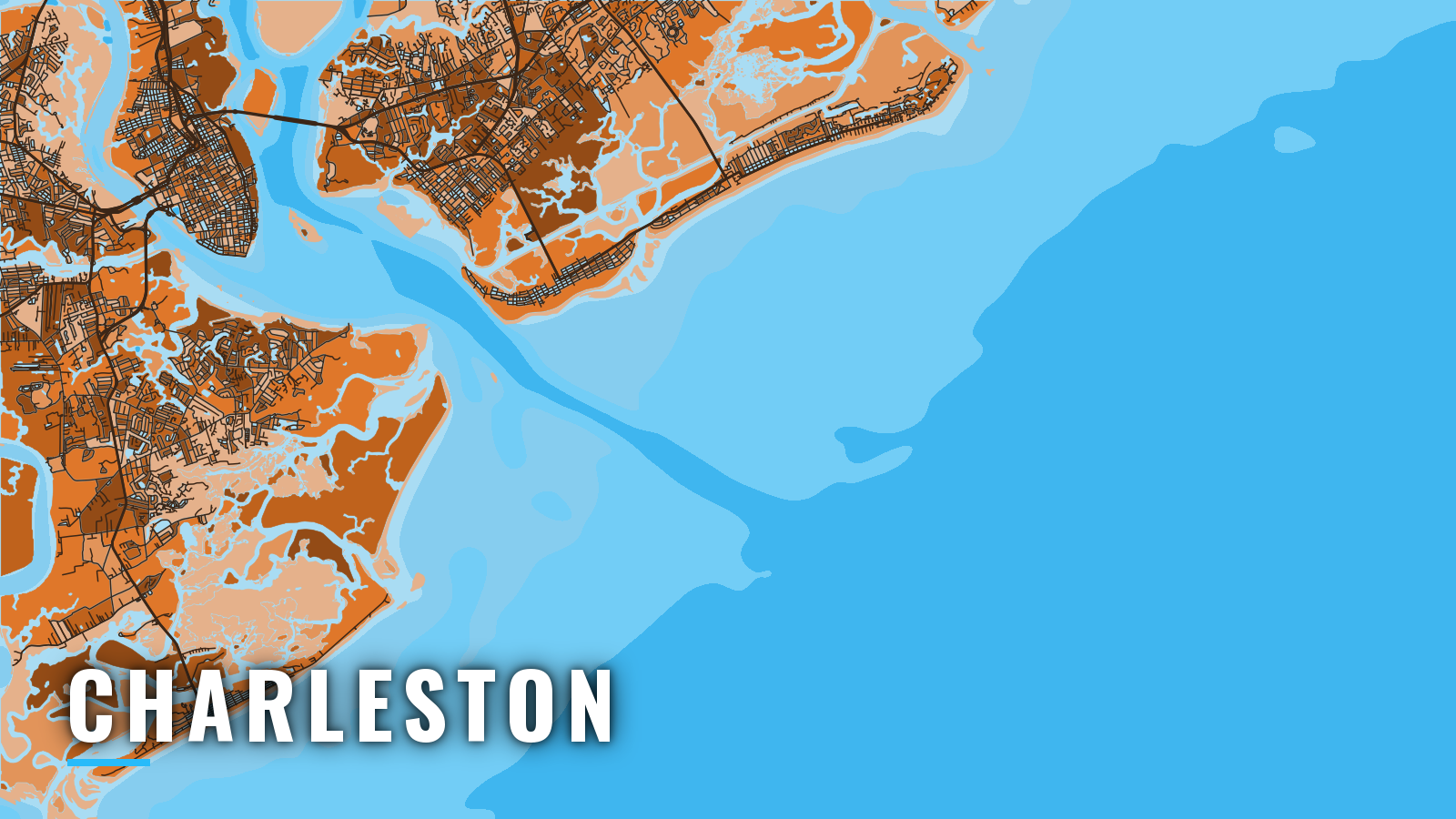
Offshore fishing out of Charleston starts between two jetties that converge and run nearly 3 miles into the Atlantic. The harbor is fed by the Cooper, Wando and Ashley Rivers, with facilities at Shem Creek, Mount Pleasant and on the Cooper River. Boats fish jetty rock, nearshore and offshore reefs, and Gulf Stream trolling water. The water fishes year-round, with bottom species in winter and pelagics from spring through autumn. Anglers target cobia, king mackerel, amberjack, black sea bass, grouper, wahoo, mahi-mahi and tuna, the same mix covered in our Atlantic Southeast fishing guide.
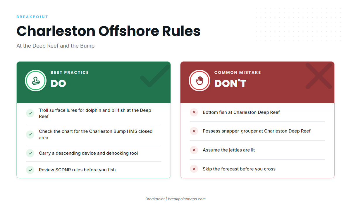
Seasons, size limits and bag limits are in the SCDNR Marine Resources Division rules, so check them before you fish. The state/federal line is on our South Carolina page. Snapper-grouper trips also call for a dehooking tool and a descending device ready for use, and the descending device release guidance shows how to use one.
Access and navigation
Five county landings and three marinas put you on the harbor.
Public ramps:
- Remley’s Point Boat Landing – CCPRC landing in Mount Pleasant
- Shem Creek Boat Landing – Mount Pleasant, off the Shem Creek dredged channel
- Paradise Boat Landing – on the Wando River, Mount Pleasant
- Wappoo Cut Boat Landing – West Ashley
- W.O. Thomas Jr. Boat Landing – North Charleston
Marinas:
- Seabreeze Marina – fuel listed
- Toler’s Cove Marina – fuel listed
- Cooper River Marina – CCPRC marina on the Cooper River
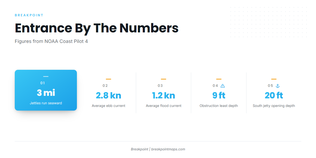
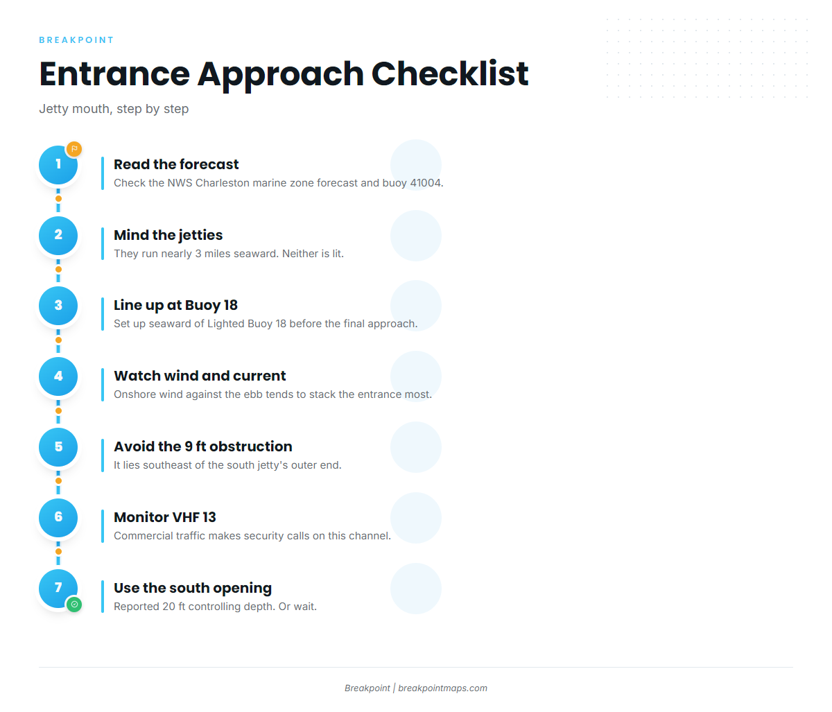
The harbor entrance runs between jetties that converge and extend nearly 3 miles seaward. The north jetty is almost completely submerged at mean high water, and neither jetty is lit. Small craft coming from the north close to shore at high water can mistake the south jetty for the north one. NOAA Coast Pilot 4, Chapter 6 advises lining up seaward of Lighted Buoy 18 before the final approach. A submerged obstruction with a least depth of 9 feet lies southeast of the south jetty’s outer end.
Current and wind decide how the entrance behaves. In the channel, average current runs about 2.8 knots on the ebb and about 1.2 knots on the flood. When wind runs against current, tide rips can form off the jetties, and an onshore wind against the ebb tends to stack the entrance most. Off the entrance the current is rotary at about 1 knot, and an inshore set of a knot or more can occur from indraft into the nearby inlets.
A buoyed opening in the south jetty has a reported controlling depth of 20 feet and is an option when the main entrance looks rougher than you want. Charleston Harbor is also a deep-draft ship channel, where passing ships can cause surge and, in shallow water, high waves even at minimal speed. Where the Intracoastal Waterway meets the harbor, westbound vessels are hard to see from boats inbound from sea, and crosscurrents there can be strong and unpredictable. Commercial traffic makes security calls on VHF 13, so monitor it.
On arrival, look at the water first, then read the NWS Charleston marine zone forecast and NDBC buoy 41004, Edisto, 41 NM southeast of Charleston. The buoy reports offshore conditions, not those at the jetty mouth, and a forecast is only a forecast. If the entrance looks bigger than you want, use the south jetty opening or wait.
Fishing conditions
The grounds step out from jetty rock to South Carolina artificial reef sites, then deeper wrecks, the Ledge and the Gulf Stream. Beyond the shelf you are in Gulf Stream trolling for sailfish water.
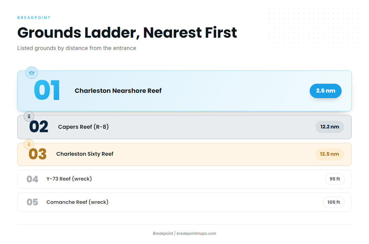
Named grounds, nearest first:
- Charleston Harbor jetties – rock
- Charleston Nearshore Reef – reef, 2.5 nm from the entrance, 30 ft
- Capers Reef (R-8) – reef, 12.2 nm, 45 ft
- Charleston Sixty Reef – reef, 12.5 nm, 60 ft
- Y-73 Reef – wreck, 95 ft
- Comanche Reef – wreck, 105 ft
- The Ledge – ledge
The Charleston Deep Reef lies about 52 miles off the central coast. SCDNR designates it a Type II marine protected area where bottom fishing and possession of snapper-grouper are prohibited, though surface trolling for pelagics such as dolphin and billfish is allowed. The waters east and southeast of the harbor see extensive Navy training, and a Charleston Bump closed area for highly migratory species is charted, so check the chart before you set lines.
Breakpoint’s OBS SST, Chlorophyll and Chart Contours layers show where the edges sit before you run 50-plus miles. Chart layers are not for navigation.
Winter
Winter fishing is bottom and structure work. Black sea bass, grouper and sheepshead are the main targets over reefs, wrecks and jetty rock. Have your dehooking tool and descending device rigged before the first drop.
Spring
Spring brings cobia, amberjack, king and Spanish mackerel, bluefish, black drum and shark to the nearshore and the reefs. Offshore, the trolling water produces wahoo, mahi-mahi, tuna and blue marlin.
Mahi-mahi (dolphin) run the weed lines and edges, and the mahi-mahi guide covers how to work them. The wahoo guide covers high-speed trolling. Spring is also when blue marlin show up for boats that run deep.
Summer
Summer carries the full pelagic list: blue marlin, sailfish, wahoo, mahi-mahi, tuna, king mackerel, barracuda, cobia, amberjack and shark. Bottom anglers can fish black sea bass, snapper, grouper, porgy and flounder. The Gulf Stream is the place for blue marlin in the Atlantic Southeast, and sailfish share that blue water.
The same trolling water holds other billfish, including white marlin, and the Atlantic Southeast white marlin guide has the regional detail. Keep in mind that the Deep Reef is troll-only, since bottom fishing there is prohibited.
Autumn
Autumn brings cobia, king mackerel, amberjack and shark to the reefs and nearshore structure, and bull red drum around the jetties.