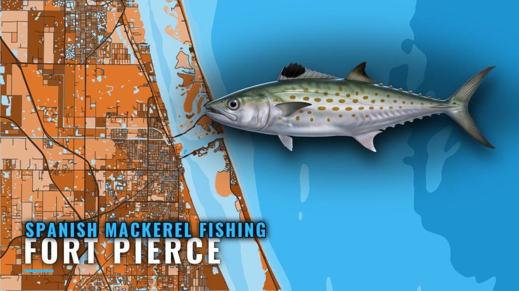
When Spanish mackerel are off Fort Pierce
Spanish mackerel fishing out of Fort Pierce starts at Fort Pierce Inlet. The structure within reach falls into three groups: shoals, one nearshore reef, and a set of SL-series artificial wrecks. This page lays those grounds out from the inlet outward for anglers running their own boat. Inlet detail and conditions are in the Fort Pierce port guide. The aim is to help you decide which structure to try, not to promise fish.
Timing along this coast is covered in the Atlantic and Southeast Spanish mackerel guide (see also the Atlantic Southeast offshore fishing guide). How the fish behave, feed and move is in the Spanish mackerel species guide. This page stays on the grounds themselves.
Running out of Fort Pierce Inlet
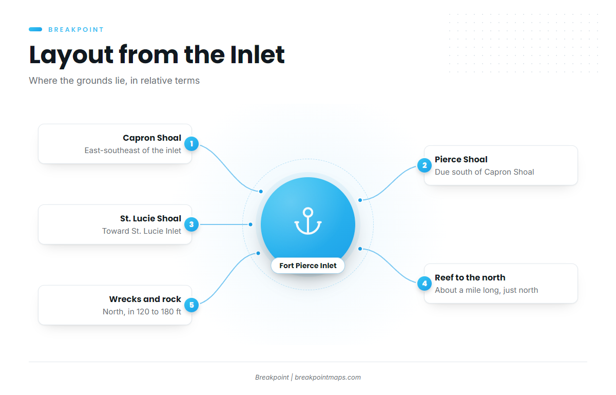
Boats work out of the Fort Pierce Inlet area. From the inlet, the shoals lie east-southeast and south, toward St. Lucie Inlet. One reef lies just north of the inlet, and the deep wrecks and rock lie north of it, in 120 to 180 ft of water.
Check wind, wave height and period before the run. The NWS Melbourne marine forecast covers the zone, and the Fort Pierce wave buoy gives measured numbers. For entrance notes, see the Coast Pilot inlet notes.
Grounds and structure near Fort Pierce
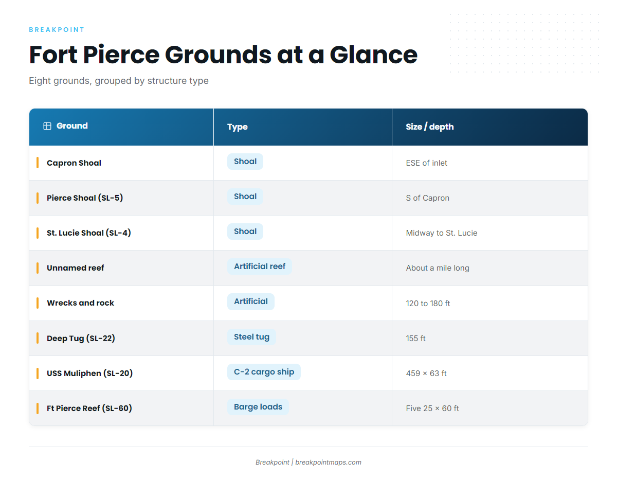
The grounds sort into three types: shoals, one nearshore artificial reef, and deep artificial wrecks and rock. The SL numbers below are the site labels used for these grounds.
Type matters for planning. A shoal is a raised area of bottom, a wreck is a single steel hull, and barge loads are placed material. Match the trip to the structure you want to fish.
| Ground | SL number | Type | Position | Size / depth |
|---|---|---|---|---|
| Capron Shoal | n/a | Shoal | East-southeast of Fort Pierce Inlet | n/a |
| Pierce Shoal | SL-5 | Shoal | Due south of Capron Shoal | n/a |
| St. Lucie Shoal | SL-4 | Shoal | About halfway between Fort Pierce and St. Lucie inlets | n/a |
| Unnamed reef | n/a | Artificial reef | Just north of Fort Pierce Inlet | About a mile long |
| Wrecks and rock areas | n/a | Artificial wrecks, rock | North of Fort Pierce Inlet | 120 to 180 ft of water |
| Deep Tug | SL-22 | Steel tug | n/a | 155 ft |
| USS Muliphen | SL-20 | C-2 attack cargo ship | n/a | 459 x 63 ft |
| Ft Pierce Artificial Reef | SL-60 | Barge loads | n/a | Five 25 x 60 ft loads |
Swipe the table sideways to see every column.
Chart Contours shows the shoal edges and the wreck sites. Chart layers are not for navigation.
Capron Shoal
Capron Shoal lies east-southeast of the inlet. It is the first reference point in the shoal sequence, and the other two shoals are located relative to it.
Pierce Shoal (SL-5)
Pierce Shoal carries the label SL-5 and lies due south of Capron Shoal. On the chart, the two read as a pair.
St. Lucie Shoal (SL-4)
St. Lucie Shoal carries the label SL-4 and lies about halfway between Fort Pierce and St. Lucie inlets. St. Lucie Inlet is the southern reference point.
The reef north of the inlet
An unnamed artificial reef about a mile long lies just north of Fort Pierce Inlet. It is the closest structure to the inlet on this list.
Wrecks and rock in 120 to 180 ft
Artificial wrecks and rock areas sit north of the inlet in 120 to 180 ft of water. This is the deepest band on the page.
USS Muliphen (SL-20)
USS Muliphen carries the label SL-20. It is a C-2 attack cargo ship, 459 x 63 ft, and the largest single structure listed here.
Deep Tug (SL-22)
Deep Tug carries the label SL-22. It is a 155-foot steel tug, listed as Ft Pierce Artificial, Deep Tug.
Ft Pierce Artificial Reef (SL-60)
Ft Pierce Artificial Reef carries the label SL-60. It consists of five barge loads, each 25 x 60 ft.
Working the structure
Tactics are in the species guide linked above and are not repeated here. For planning, the shoals and the reef north of the inlet are the closer reference points, and the wrecks and rock in 120 to 180 ft are the deeper option. Compare the forecast and buoy numbers for wind, wave height and period, then pick the structure that fits the day.
FAQ about Spanish mackerel fishing out of Fort Pierce
Where are the shoals off Fort Pierce?
Three shoals anchor the chart. Capron Shoal lies east-southeast of the inlet. Pierce Shoal (SL-5) lies due south of Capron Shoal. St. Lucie Shoal (SL-4) lies about halfway between Fort Pierce and St. Lucie inlets.
What is the USS Muliphen?
USS Muliphen is site SL-20, a C-2 attack cargo ship measuring 459 x 63 ft, placed as an artificial reef. It is the largest single structure on this list.
How deep are the wrecks north of Fort Pierce Inlet?
The artificial wrecks and rock areas north of the inlet sit in 120 to 180 ft of water. Check wind, wave height and period in the forecast and buoy numbers before you commit to the deeper run.
What is Ft Pierce Artificial Reef (SL-60) made of?
Ft Pierce Artificial Reef (SL-60) is five barge loads, each 25 x 60 ft. That is placed material, whereas Deep Tug (SL-22) is a single steel hull 155 ft long.
What else uses this structure?
King mackerel and other species use similar structure along this coast. See the coastal and offshore gamefish guides for king mackerel and the rest.