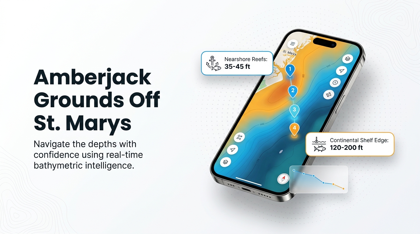
Greater amberjack fishing out of St. Marys runs from the inlet jetties to the continental shelf, over wrecks and hard bottom in roughly 40 to 200 ft. The nearest reefs sit 8 nautical miles out, and the Ledge lies in 120 to 200 ft. Starting at the inlet at St. Marys, this page works outward through where the structure sits, how deep it is and how far boats run. For the wider coast, see the greater amberjack fishing in the Atlantic Southeast and the wider Atlantic Southeast guide.
When greater amberjack are around St. Marys
According to Rainbreak’s offshore trip listing, greater amberjack are around St. Marys from spring through fall, with spawning in April and May. That is a broad window, and the listing does not name a peak month.
Spawning fish gather on reefs and wrecks, so the structure listed below is where to look. For biology and spawning detail, read the greater amberjack guide.
How far boats run from St. Marys Inlet
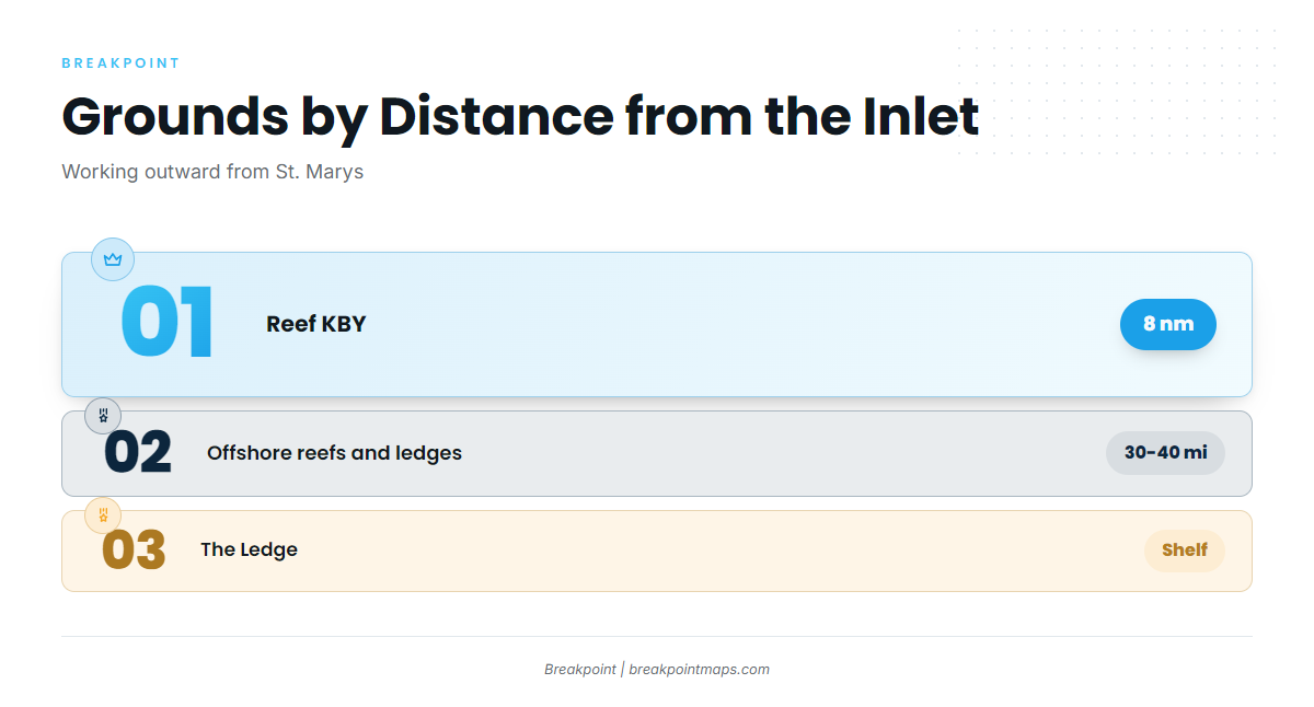
Runs from St. Marys Inlet range from 8 nautical miles to the nearshore reefs out to the continental shelf. Distance is the main thing that sorts the grounds.
Nearshore reefs
Reef KBY sits 8 nautical miles east of Cumberland Island in 35 to 45 ft. The tug Brenda K. lies in about 50 ft at KBY. Reef MRY is deeper, at 63 ft at the vessel.
30 to 40 miles
Rainbreak Charters’ 6-hour and 8-hour offshore trips run up to 30 and 40 miles, and both list amberjack. That run reaches reefs and ledges, and it shows where the local fleet goes.
The Ledge
The Ledge, also called the Big Ledge, is continental shelf. Trolling starts at 120 ft and runs to 200 ft. Rainbreak runs 12-hour trips to the Ledge.
Grounds and structure that hold amberjack
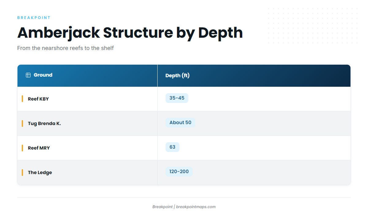
The table lists the named grounds near St. Marys, from the inlet outward. Blank cells mean no figure is published for that ground.
| Name | Depth (ft) | Location note |
|---|---|---|
| St. Marys jetties (north and south) | At St. Marys Inlet | |
| St. Marys Sea Buoy | Offshore reference point | |
| FA fish haven | Florida side of the inlet; live bottom, tug and barge | |
| Reef KBY | 35-45 | 8 nautical miles east of Cumberland Island |
| Tug Brenda K. | about 50 | At KBY |
| Reefs A and CDH | Listed as nearby reefs to KBY | |
| Reef MRY (Metalmorphosis) | 63 at the vessel | Deeper, clearer water than KBY |
| The Ledge (Big Ledge) | 120-200 | Continental shelf |
St. Marys jetties
The north and south jetties at St. Marys Inlet are the innermost structure on the list.
St. Marys Sea Buoy
The St. Marys Sea Buoy is the reference mark where offshore runs begin.
FA fish haven
The FA fish haven is live bottom with a tug and barge. It sits on the Florida side of the inlet, which affects which rules apply (see the regulations section below).
Reef KBY
KBY sits in 35 to 45 ft, 8 nautical miles east of Cumberland Island. The tug Brenda K. lies in about 50 ft at KBY, at 30.805283, -81.27555. Use the coordinates for planning only; chart layers are not for navigation.
Reefs A and CDH
Reefs A and CDH are listed as nearby reefs to KBY.
Reef MRY (Metalmorphosis)
MRY is a 52-ft steel vessel in 63 ft. Georgia DNR describes MRY as deeper with clearer water than KBY.
The Ledge (Big Ledge)
The Ledge is continental shelf, with trolling from 120 to 200 ft. Rainbreak’s 12-hour trips run here.
How amberjack are fished out of St. Marys
Local anglers fish heavy tackle on wrecks and hard bottom, from the nearshore wrecks out to the Ledge. The notes below cover the method and who fishes these grounds.
Heavy tackle on wrecks and hard bottom
At the Ledge, trolling is the method, over 120 to 200 ft. For the regional picture of bottom fishing and the other reef species that share this structure, see the reef fish guides.
Who fishes them here
Rainbreak Charters, run by Captain James (Michael) Walker, lists amberjack on two kinds of trip:
- 6-hour and 8-hour offshore trips that run up to 30 and 40 miles
- 12-hour trips to the Ledge
Private boats work the same grounds, from KBY and MRY out to the Ledge.
FAQ: greater amberjack out of St. Marys
How far is Reef KBY from St. Marys?
KBY is 8 nautical miles east of Cumberland Island, in 35 to 45 ft. The tug Brenda K. sits on it in about 50 ft.
How deep is Reef MRY?
MRY is 63 ft at the Metalmorphosis, a 52-ft steel vessel. Georgia DNR describes MRY as deeper with clearer water than KBY.
Where is the tug Brenda K.?
The Brenda K. lies at KBY in about 50 ft, at 30.805283, -81.27555. Use the coordinates for planning, not navigation.
Does a local charter target amberjack out of St. Marys?
Rainbreak Charters, run by Captain James Michael Walker, lists amberjack on its 6-hour and 8-hour offshore trips, which run up to 30 and 40 miles. It also runs 12-hour trips to the Ledge at 120 to 200 ft.
Where are the amberjack rules for St. Marys?
Georgia DNR sets the state rules. Check the Georgia regulations page before fishing. The FA fish haven is on the Florida side of the inlet, so a trip can cross into Florida waters.