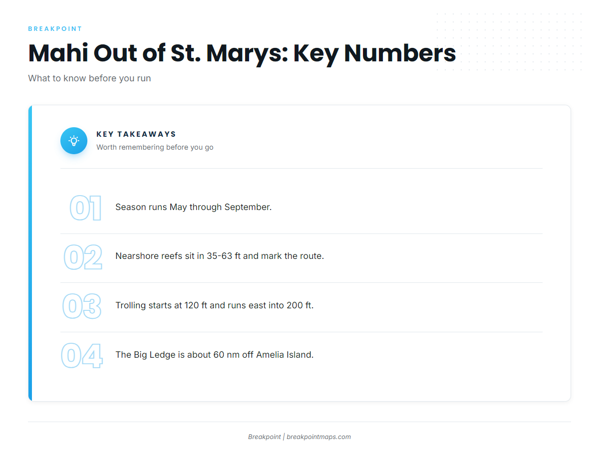
The St. Marys mahi season runs May through September. Trolling water starts at 120 ft and runs east into 200 ft toward the Big Ledge. The St. Marys port page covers the inlet itself.
The named reefs off Cumberland Island sit in 35-63 ft and mark the route out; they are waypoints, not mahi water. Charters here list the fish as dolphin.
This page lists the waypoints in order from the jetties outward, with depths and coordinates where they exist.
When mahi are off St. Marys
Rainbreak’s trip listings give the mahi season here as May through September, so plan around that window. The Southeast Atlantic mahi guide (see also the Atlantic Southeast region guide) covers how the run plays out along the rest of the coast.
How far boats run for mahi from St. Marys
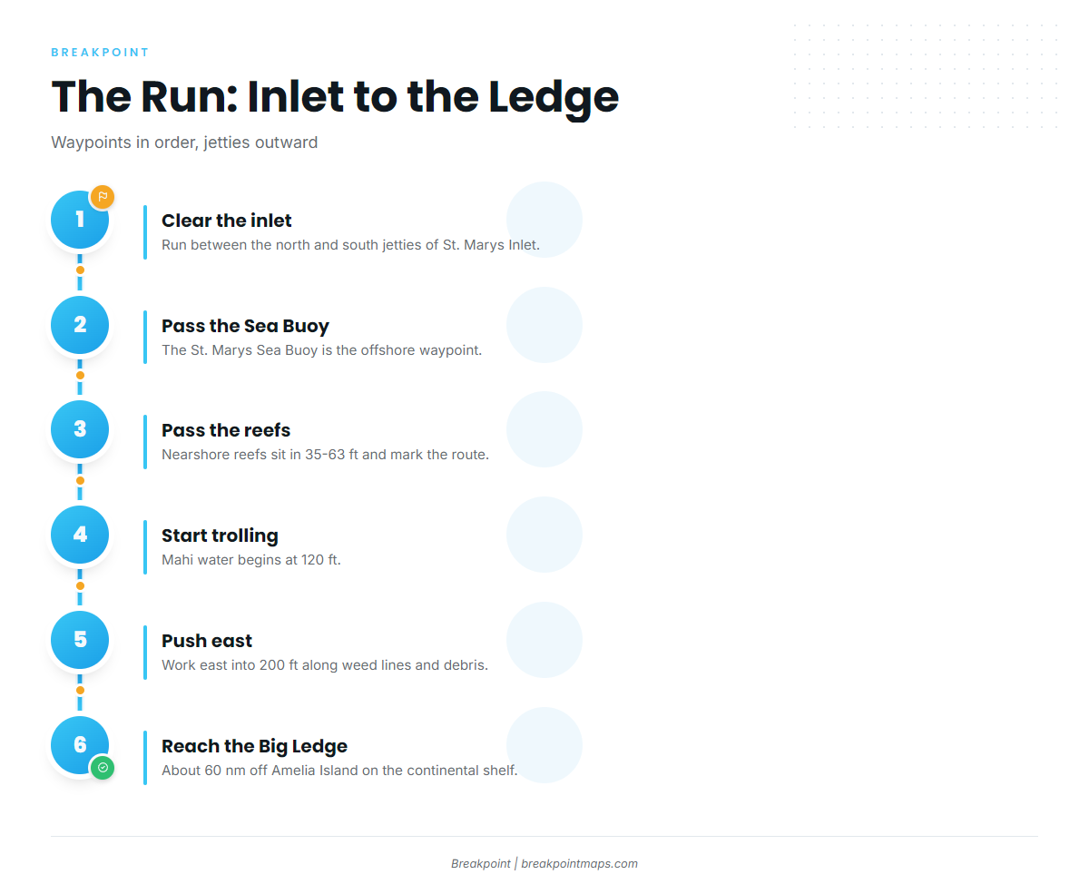
The run goes in this order:
- Clear St. Marys Inlet between the north and south jetties.
- Pass the St. Marys Sea Buoy.
- Pass the nearshore reefs in 35-63 ft.
- Start trolling at 120 ft.
- Push east into 200 ft.
- Reach the Big Ledge, about 60 nm off Amelia Island, on the continental shelf.
For scale, Rainbreak lists dolphin on its 10-hour trip, which ranges up to 60 miles, and on its 12-hour Ledge trip. Those trip lengths give a sense of how much time on the water this run takes. Check the official NWS marine forecast before you run this far.
Grounds and structure on the run east
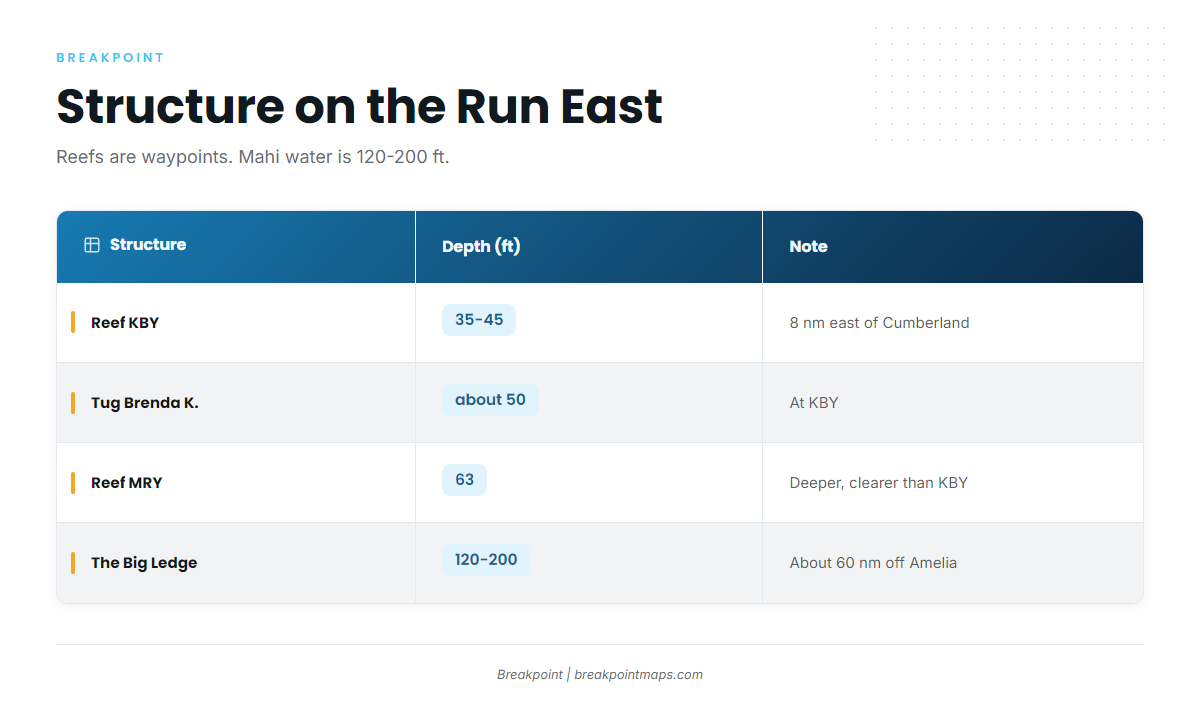
Everything inside the 63 ft line is route structure. The mahi water starts at 120 ft.
| Structure | Depth (ft) | Location note |
|---|---|---|
| St. Marys jetties (north and south) | St. Marys Inlet | |
| St. Marys Sea Buoy | ||
| Reef KBY | 35-45 | 8 nm east of Cumberland Island |
| Tug Brenda K. | about 50 | At KBY, 30.805283, -81.27555 |
| Reef MRY (Metalmorphosis) | 63 at the vessel | Deeper, clearer water than KBY |
| Reefs A and CDH | Nearby reefs listed on the KBY page | |
| FA fish haven | Florida side of the inlet, live bottom, tug and barge | |
| The Ledge / Big Ledge | 120-200 trolling band | About 60 nm off Amelia Island |
Load the coordinates into your plotter or view them against the Chart Contours layer for planning. Chart layers are not for navigation.
St. Marys jetties and Sea Buoy
The north and south jetties mark St. Marys Inlet. The St. Marys Sea Buoy is the waypoint where the offshore run begins.
Reef KBY and the tug Brenda K.
Georgia DNR places Reef KBY in 35-45 ft, 8 nm east of Cumberland Island. The tug Brenda K. sits at KBY in about 50 ft, at 30.805283, -81.27555.
Reef MRY (Metalmorphosis)
Metalmorphosis is a 52-ft steel vessel with 63 ft of water at the vessel. DNR describes MRY as deeper, with clearer water than KBY.
Reefs A and CDH
DNR’s KBY page lists Reefs A and CDH as nearby reefs.
FA fish haven
The FA fish haven sits on the Florida side of the inlet. It has live bottom plus a tug and barge. Because it is across the state line, the rules below apply to it differently.
The Ledge
The Big Ledge is part of the continental shelf, about 60 nm off Amelia Island. Trolling runs from 120 ft out to 200 ft. Rainbreak runs 12-hour trips to the Ledge. This is the mahi water.
How mahi-mahi fishing out of St. Marys works
Boats here troll ballyhoo and lures along weed lines and floating debris. Once you are past 120 ft and working east, look for the weed lines and debris. The Florida Fish and Wildlife Conservation Commission also describes cruising weed lines offshore as a way to find mahi.
Rigging and the biology behind weed lines are in the mahi-mahi species guide. Use this page to decide where to look; it does not promise where the fish will be.
Who fishes them from St. Marys
Rainbreak Charters, run by Captain James (Michael) Walker, lists dolphin on its 10-hour trip (up to 60 miles) and its 12-hour Ledge trip. See the Rainbreak Charters trip listings for details.
Other offshore species from this coast are covered in the offshore gamefish guides.
FAQ: Mahi out of St. Marys
When is mahi season out of St. Marys?
May through September, per Rainbreak’s trip listings. That is the window for mahi-mahi fishing out of St. Marys.
How far offshore do you run for mahi from St. Marys?
Trolling starts at 120 ft and runs east into 200 ft. Rainbreak’s dolphin trips range up to 60 miles, and its 12-hour trips go to the Ledge.
What depth do you start trolling for mahi?
120 ft, working east into 200 ft along weed lines and floating debris.
How far is the Big Ledge?
About 60 nm off Amelia Island, on the continental shelf.
Do the nearshore reefs like KBY hold mahi?
KBY (35-45 ft), the Brenda K. (about 50 ft) and MRY (63 ft) are route structure. The mahi water is 120-200 ft.
Who runs mahi trips from St. Marys?
Rainbreak Charters, with Captain James (Michael) Walker. It runs 10-hour trips up to 60 miles and 12-hour Ledge trips that list dolphin.