Sailfish fishing out of St. Marys means choosing between nearshore reefs in 35 to 63 ft and the Ledge, trolled from 120 to 200 ft. This guide follows the order a boat runs the water: inlet, reefs, Ledge. It gives depths, coordinates and structure and leaves the decision about where to look to you.
When sailfish are off St. Marys
Fernandina-side sources say summer is best. Fernandina shares the same inlet and the same water, so that timing carries over to St. Marys. For general timing and biology, use the sailfish guide. For the wider picture beyond this port, read the Atlantic Southeast sailfish guide (see also the wider Atlantic Southeast guide).
Running out of St. Marys Entrance
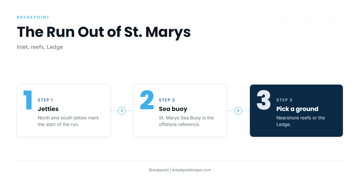
Every run starts in St. Marys port page waters: from the jetties to the St. Marys Sea Buoy, then on to either the nearshore reefs or the Ledge. Read wind, wave height and period in the NWS Jacksonville marine forecast and on the offshore Fernandina NDBC buoy. Fernandina and Cumberland Island sit on either side of the same entrance.
The route in order:
- Jetties. North and south, at St. Marys Inlet.
- St. Marys Sea Buoy. The route splits here.
- Reefs or Ledge. Pick by depth and water clarity.
The jetties
The north and south jetties at St. Marys Inlet mark the start of the run. The Coast Pilot entrance chapter is the reference for the entrance.
The sea buoy
The St. Marys Sea Buoy is the offshore reference where the route splits toward the reefs or the Ledge.
Nearshore reefs and structure
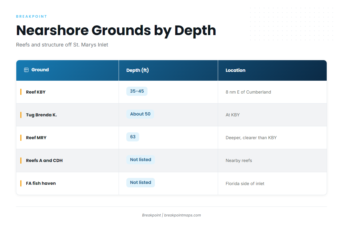
Choosing among the reefs comes down to depth and water clarity. Georgia DNR manages them, and the grounds line up like this:
| Ground | Depth (ft) | Location note |
|---|---|---|
| Reef KBY | 35-45 | 8 nm east of Cumberland Island |
| Tug Brenda K. | about 50 | At KBY, 30.805283, -81.27555 |
| Reef MRY (Metalmorphosis) | 63 at the vessel | Deeper, clearer water than KBY (Georgia DNR) |
| Reefs A and CDH | Not listed | Listed as nearby reefs on the KBY page |
| FA fish haven | Not listed | Florida side of the inlet |
Reef KBY
Reef KBY sits in 35 to 45 ft, 8 nautical miles east of Cumberland Island. Georgia DNR’s Reef KBY page is the agency source for the ground.
Tug Brenda K.
The tug sits at KBY in about 50 ft. Coordinates:
30.805283, -81.27555
Reef MRY
Metalmorphosis is a 52-ft steel vessel with 63 ft of water at the vessel. Georgia DNR says MRY has deeper, clearer water than KBY, which makes it the option when clarity matters.
Reefs A and CDH
Georgia DNR lists Reefs A and CDH as nearby reefs on the KBY page.
FA fish haven
The FA fish haven is live bottom with a tug and barge, on the Florida side of the inlet. Jurisdiction is covered under Regulations below.
The Ledge
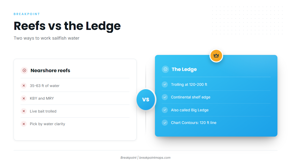
The Ledge, also called the Big Ledge, is the continental shelf edge. Trolling starts at 120 ft and runs to 200 ft. Compared with the reefs at 35 to 63 ft, that means deeper water and a bigger commitment of time and fuel, and it is the depth line that divides sailfish fishing out of St. Marys.
Chart Contours shows the 120 ft line where Ledge trolling starts. Chart layers are not for navigation.
How sailfish are fished here and who fishes them
Methods follow the grounds, and local anglers use two. For tactics beyond this port, see the billfish guides.
- Rigged ballyhoo. The local trolling method.
- Live bait at the reefs. Trolled at KBY and MRY.
- Charter trips. Rainbreak runs 12-hour trips to the Ledge.
Rigged ballyhoo
Rigged ballyhoo is the local method for trolled baits.
Live bait at the reefs
Live bait is trolled at the reefs, which ties it to KBY and MRY.
Charters and Rainbreak’s 12-hour Ledge trips
Rainbreak runs 12-hour trips to the Ledge.
FAQ about sailfish fishing out of St. Marys
How far is Reef KBY?
Reef KBY is 8 nautical miles east of Cumberland Island, in 35 to 45 ft.
What depth is Reef MRY?
Reef MRY is 63 ft at the vessel. Georgia DNR says it is deeper with clearer water than KBY.
What are the Brenda K. coordinates?
30.805283, -81.27555, at KBY, in about 50 ft.
Where does Ledge trolling start?
Ledge trolling starts at 120 ft and runs to 200 ft along the continental shelf edge.
When is the best season?
Fernandina-side sources say summer is best.
Which methods are used here?
Rigged ballyhoo, and live bait trolled at the reefs.