
About St. Marys
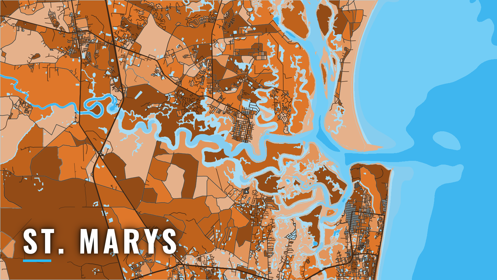
St. Marys is the southernmost port on the Georgia coast, a river town on the north bank of the St. Marys River about 4 miles above the mouth.
Boats reach the Atlantic through Cumberland Sound and St. Marys Entrance, the jettied inlet shared with Fernandina Beach and the Kings Bay submarine base. The open-water season runs spring through autumn. Offshore targets are cobia, mahi-mahi, red snapper, black sea bass and greater amberjack, with redfish and sheepshead on the jetties.
Access and navigation
Public launch and marina options in town:
- St. Marys Waterfront Park ramps – two ramps, downtown
- Meeting Street ramp – two ramps, parking, restrooms
- Crooked River State Park ramp – state park ramp on the Crooked River
- Harriett’s Bluff ramp – Crooked River, north of town
- St. Marys Intracoastal Gateway Marina – city-owned, east of Waterfront Park
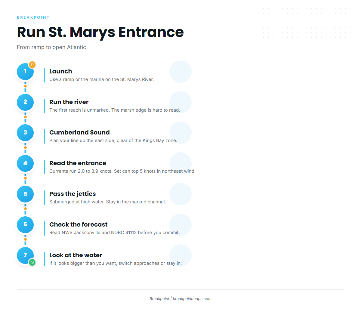
The first reach of the St. Marys River has an unmarked channel. According to Coast Pilot 4, Chapter 8, the marsh shoreline is indefinite and can be hard to follow, particularly in late afternoon, which is often when you are coming home. Currents are reported as unpredictable at the river entrance, at the Jolly and North River junctions, and along the piers at St. Marys.
A security zone covers the west side of Cumberland Sound, from Mill Creek north around the Kings Bay entrance and Crab Island to Cherry Point. Regulated navigation areas also lie in the sound near Kings Bay. The limits are in 33 CFR 165.730 to 165.732. Plan your line up the east side of the sound.
The run gets harder at St. Marys Entrance. The two stone jetties are reported to be in very poor condition and almost entirely submerged at mean high water, and white JETTY buoys mark their approximate positions. The marked channel carries federal project depths of 44 to 46 feet.
Maximum currents are reported at 2.0 to 3.9 knots. The flood generally sets northwestward and the ebb southeastward. In northeast winds, a strong southerly set is reported off the jetty ends on both tides, sometimes above 5 knots. An ebb running against a northeast or east wind can stand the bar up, and the southerly set can push you toward the south jetty end. A buoy marks the natural channel off the north jetty end. Boats turning north use it, and there is a reported danger of being set into the jetty end.
The Coast Pilot places St. Andrew Sound 17 miles north of St. Marys Entrance. It can be an option when the entrance looks bigger than you want. The Intracoastal Waterway runs inside toward the Golden Isles and on to Darien.
Before you commit, read the NWS Jacksonville marine forecast for zones AMZ450 and AMZ470, which cover Altamaha Sound to Fernandina Beach. Check wave height and period at NDBC buoy 41112. That buoy sits offshore of Fernandina Beach and does not measure the bar, and a forecast is only a forecast. On arrival, look at the water yourself. If it looks bigger than you want, switch approaches or stay in.
Fishing conditions
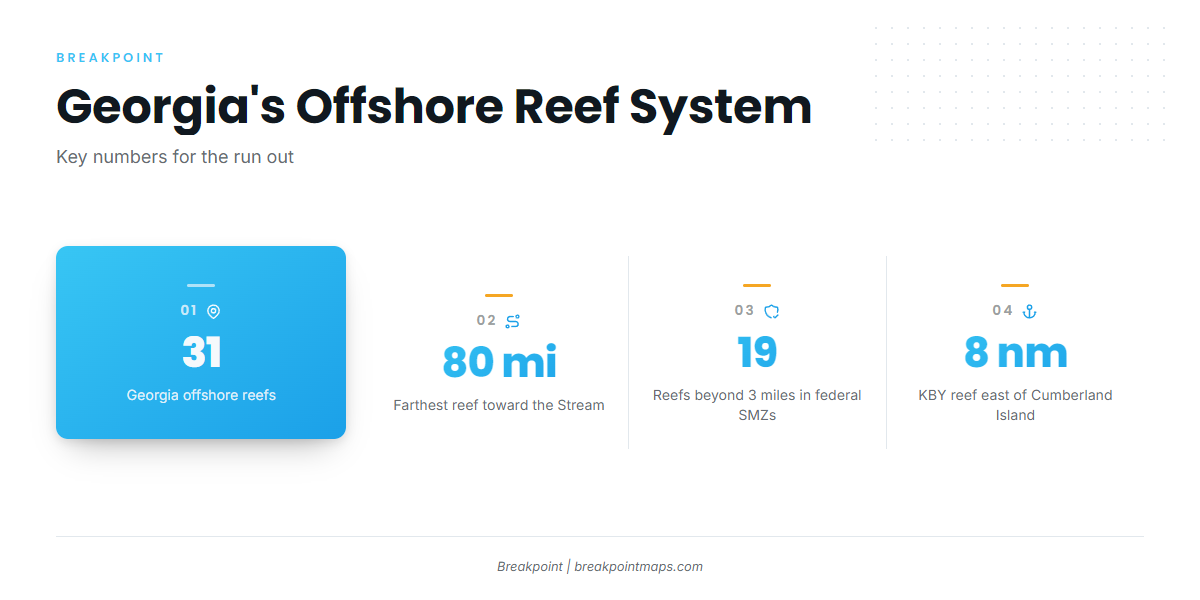
The named grounds off St. Marys are the north and south jetties at St. Marys Entrance and Georgia DNR artificial reef KBY, 8 nautical miles east of Cumberland Island in 45 ft.
The jetty rock holds redfish, sheepshead, sea trout and flounder by season. KBY is the nearshore step out, with black sea bass, amberjack and cobia. Farther out, Georgia’s 31 offshore reefs reach 80 miles offshore toward the Gulf Stream edge. The 19 reefs beyond 3 miles are federal special management zones, where fishing is limited to handline, rod and reel and spearfishing gear. A deepwater Georgia marine protected area closes snapper-grouper fishing, so check its boundary before you set up. The Atlantic Southeast fishing guide covers how the Stream edge moves through the year.
OBS SST and Chlorophyll show where the color and temperature edges sit before you commit to the run. A cloud pass leaves gaps, and chart layers are not for navigation.
Georgia DNR sets state-waters size, bag and season limits. Check before fishing. State waters run 0 to 3 nautical miles from shore, and federal rules apply beyond that.
Winter
Winter is the quiet season offshore from St. Marys. The cobia state season is closed, since it runs March 1 to October 31. Federal shallow-water grouper rules include a seasonal closure, so check the agency for dates. Black sea bass stay open all year under the state rule. Check buoy 41112 and OBS SST to see where warmer water sits.
Spring
The cobia state season opens March 1, and cobia are the signature target. Black sea bass and greater amberjack are on the reefs. Redfish and sheepshead are on the jetties.
Summer
Cobia, black sea bass and greater amberjack continue on the reefs. Mahi-mahi and red snapper run farther out. Red snapper rules change by season and quota, so check the agency before you go. Tarpon move along the beach and the inlet.
Autumn
Spanish mackerel, blacktip shark and greater amberjack are the targets. Redfish, sea trout, sheepshead and flounder are on the jetties. The cobia state season closes October 31.