
About Mayport
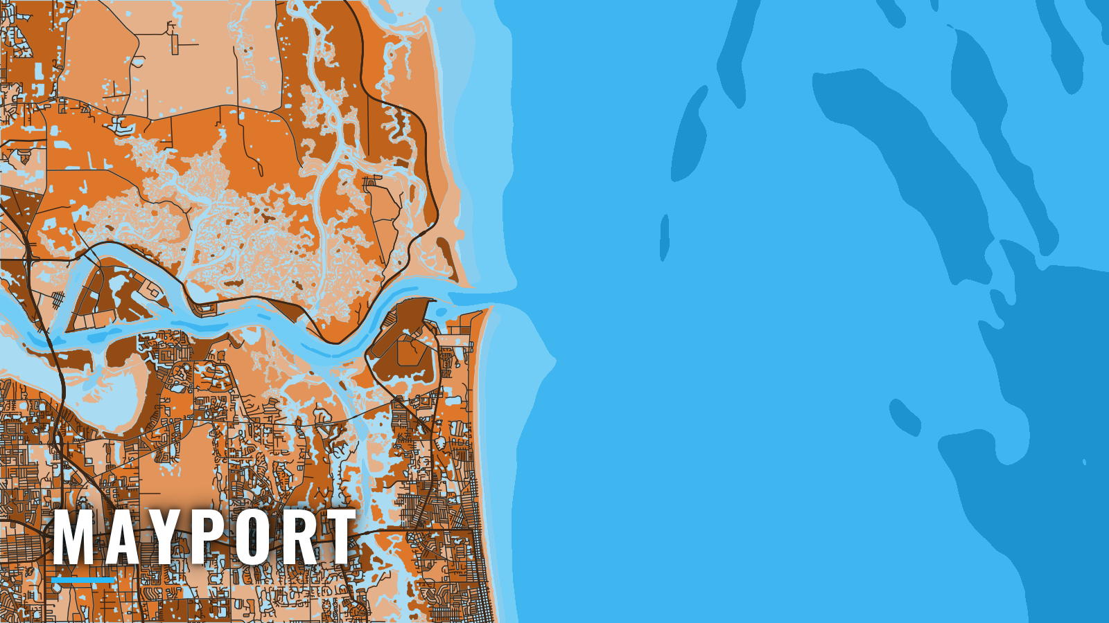
Mayport is a working village on the south bank of the St. Johns River, about 3 miles inside the entrance jetties, and it is the shortest public route from Jacksonville to offshore water. The river entrance opens to the Atlantic, Sisters Creek leads north to the Intracoastal Waterway, and reef, ledge and wreck grounds lie to the east with Gulf Stream bluewater beyond. That makes Mayport a natural gateway for Atlantic Southeast offshore fishing.
Fishing runs year-round, and the targets shift with water temperature. Anglers here work for king mackerel, cobia, mahi-mahi, wahoo, sailfish, black sea bass, snapper and amberjack. This page covers where to put in, how the entrance behaves, where to fish and when.
Access and navigation
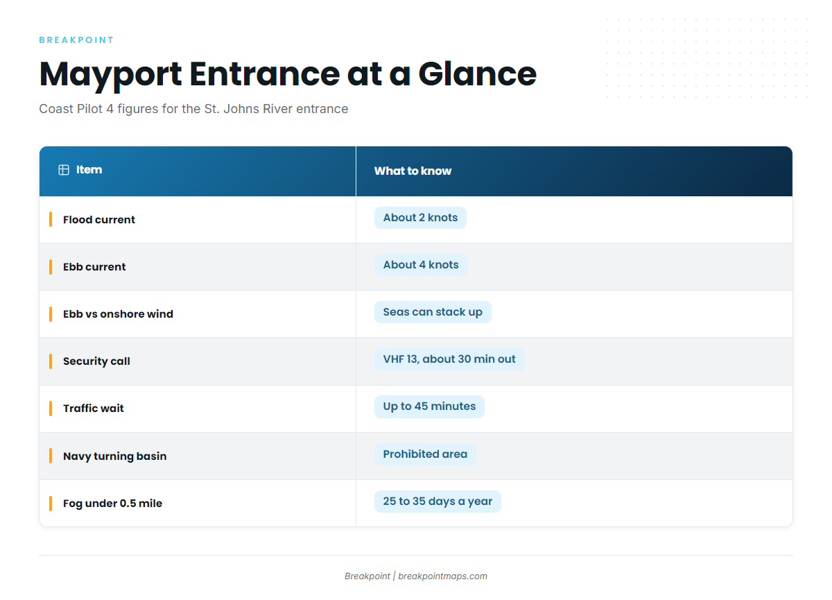
Every offshore run from Mayport goes through the St. Johns River entrance, so the ramp you pick and the tide you run on matter.
Public ramps and marinas:
- Michael B. Scanlan Mayport Boat Ramp: the city ramp closest to the jetties.
- Jim King Park and Boat Ramp at Sisters Creek: a city ramp on the ICW north of the river.
- Morningstar Marinas Mayport: transient dockage and fuel.
Current. According to NOAA Coast Pilot 4 guidance, the tidal current between the jetties runs about 2 knots on the flood and about 4 knots on the ebb. Northeast and east winds strengthen the flood, while southwest and west winds strengthen the ebb. A strong ebb running against an onshore wind or swell can stack up the seas at the jetty ends. A blow from north through east to south tends to set a strong current across the jetty ends within about an hour of starting.
Traffic. The river is a commercial and Navy channel. Vessels arriving at the bar are asked to make a Security call on VHF 13 about 30 minutes before entering, and slow or poor-handling vessels may wait up to 45 minutes for traffic to clear. Mayport Basin opens just inside the south jetty, and strong cross-currents are reported at its entrance. The Naval Station Mayport turning basin is a prohibited area, closed to pleasure vessels except in extreme emergency. People fish off the jetties and the shoreline, so watch your wake and speed.
Fog. Winter fog tends to roll in on easterly winds and can sit across the entrance after it clears elsewhere. Visibility drops under 0.5 mile on 25 to 35 days a year, most often from November through February.
Alternative approach. Sisters Creek and the ICW are the inside route to and from the entrance, putting you on the river side of the jetties without crossing open water. For the entrance itself, running on the flood or near slack tends to keep wind and current together, which is usually a better setup than a strong ebb into an easterly.
Arrival check. Look at the water at the jetty ends before you commit. Then read the NWS forecast for AMZ452 and the latest readings from NDBC 41112, paying attention to wind, wave height and period. The buoy shows conditions offshore of the entrance, not at the jetty tips. If it looks bigger than you want, change your timing, take the inside route, or stay in the river.
Fishing conditions
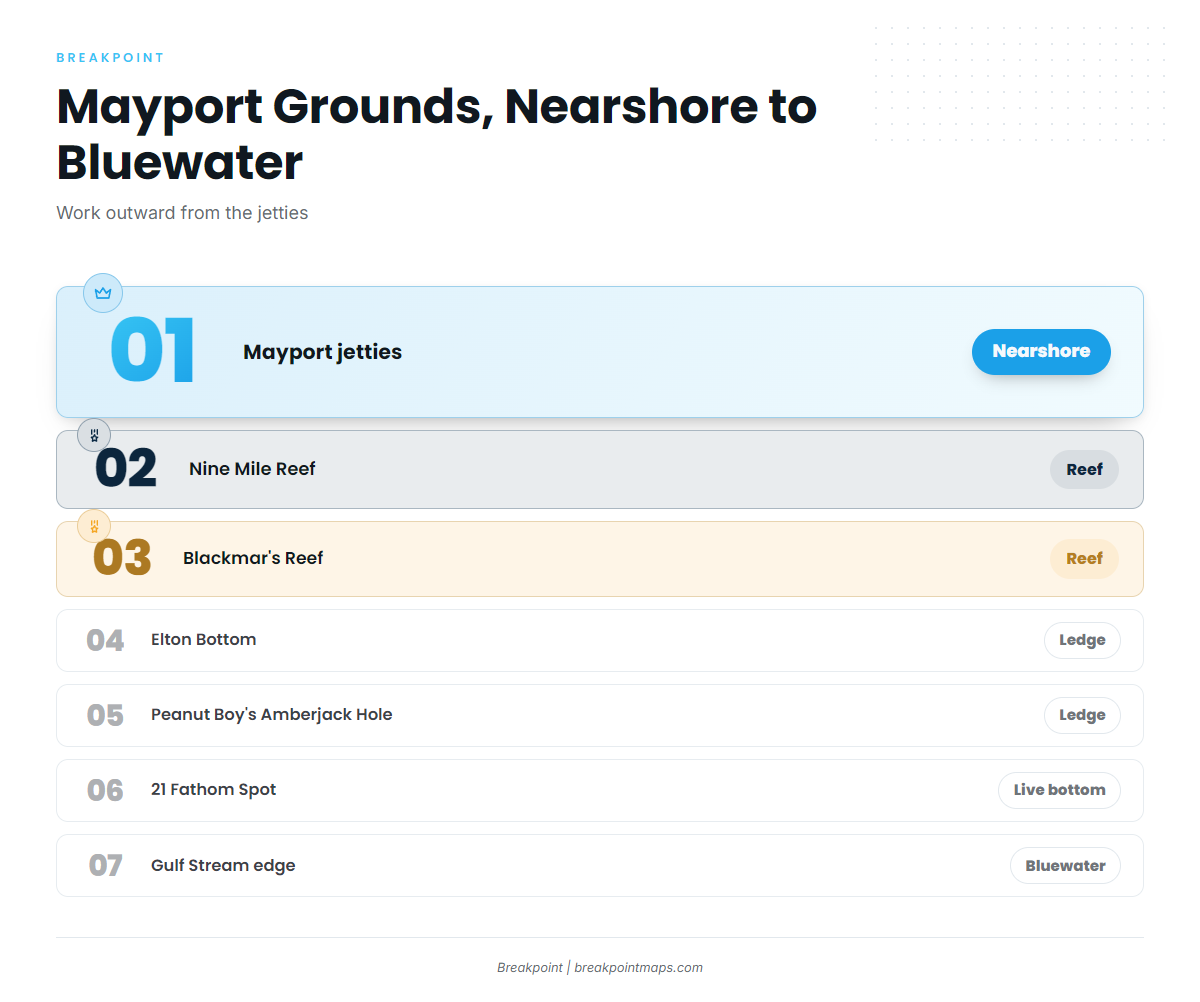
Offshore from Mayport, the grounds run from the jetties out to the Gulf Stream edge. Florida rules and the federal South Atlantic rules are on our Florida page; check them with FWC and NOAA Fisheries before fishing. Chart Contours shows the ledge edges; chart layers are not for navigation.
Grounds, nearshore to offshore:
- Nearshore: the Mayport jetties and the artificial reefs: Nine Mile Reef, Blackmar’s Reef, Casa Blanca Reef, Spike Reef (the USCG Spike tugboat), Tournament Reef and the FA Buoys.
- Ledges and live bottom: Southeast 16 & 17, Elton Bottom, Peanut Boy’s amberjack Hole, East Lump and 21 Fathom Spot.
- Bluewater: the Gulf Stream edge and its weedlines tend to hold pelagics. Fishing weedlines for mahi is a pattern worth learning here.
The ledges also hold bottom fish, and the red snapper guide covers technique. South Atlantic red snapper seasons are set by the agency and change, so check the rules above before planning a trip around them.
Winter
Black sea bass tend to hold on the reefs and ledges, and sheepshead work the nearshore structure and the jetties. Wahoo and blackfin tuna can show along the Gulf Stream edge. OBS SST shows where the edge sits on a given day, though a cloud-blocked pass can hide it.
Spring
King mackerel tend to move onto the nearshore reefs as the water warms. Cobia show near bait, rays and structure, and sheepshead can linger early in the season.
Summer
Mahi-mahi tend to hold on weedlines and color changes offshore. Mangrove and lane snapper work the ledges and reefs, and sharks and tarpon can show nearshore. OBS SST helps you find the warm edge before you burn fuel looking for it.
Autumn
The fall king run is the main event, and how to rig and slow-troll for kings is worth a read before you go. Cobia can pass through again, red drum stack at the jetties, and southern flounder can turn up around the edges.