
About Venice
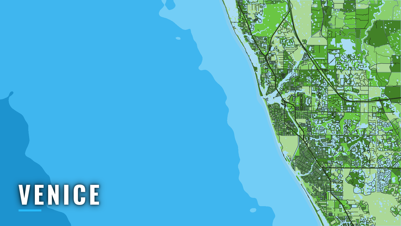
Venice sits on Florida’s Gulf Coast, where Venice Inlet runs about 0.5 mile between parallel jetties from the Intracoastal Waterway to the Gulf. It is one of Florida’s Gulf Coast ports, opening to the Gulf of America, also called the Gulf of Mexico. The port fishes through all 4 seasons, and the target species change with the calendar. Sharks lead in winter, king mackerel and cobia in spring, and tarpon, mangrove snapper and blacktip shark in summer. Grouper and king mackerel take over in autumn. This guide covers where to launch, how the inlet tends to behave, which Sarasota County artificial reefs sit at which distance and depth, and what each season offers.
Access and navigation
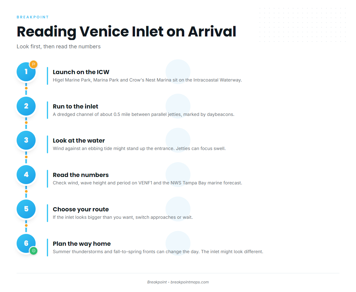
Public ramps and the marina are on the Intracoastal Waterway, a short run from Venice Inlet and the offshore grounds.
- Higel Marine Park – City of Venice ramp on the Intracoastal Waterway, a short run to the inlet.
- Marina Park and Boat Ramp – Ramp maintained by Sarasota County, with Intracoastal Waterway access.
- Crow’s Nest Marina – Just inside the inlet, fuel listed.
The inlet is a dredged channel between parallel jetties of about 0.5 mile, marked by daybeacons. Aids on Gulf passes along this coast are frequently shifted, so a daybeacon may not sit where an older chart shows it. The entrance can stand up when wind opposes an ebbing tide. The jetties can focus incoming swell at the mouth, and shoaling can occur. The channel is narrow, so watch for traffic.
The City of Venice reports that the South Jetty walkway and Humphris Park are closed after damage from Hurricanes Helene and Milton. The U.S. Army Corps of Engineers owns the jetties and is preparing a major maintenance report, so treat the structure as under review.
For orientation at night, Venice Fishing Pier is 720 feet long and about 2.5 miles south of the entrance. It is reported to be marked at its end by 2 fixed red lights.
Plan the way home before you leave the dock. Thunderstorms are most likely June through September, in the late afternoon and evening, and at sea they frequently occur at night. From fall through spring, cold fronts can bring strong, gusty winds. The inlet may look different on the way back than it did going out.
There is one alternative approach: run the Intracoastal Waterway north to Big Sarasota Pass, about 12 miles north-northwest of Venice Inlet. The Coast Pilot describes the bar and channel there as subject to continual change.
When you arrive, look at the water at the jetties, then check the numbers: wind, wave height and dominant period on NDBC station VENF1, and the NWS Tampa Bay marine forecast. A forecast is only a forecast. If the inlet looks bigger than you want, switch approaches or wait.
Fishing conditions
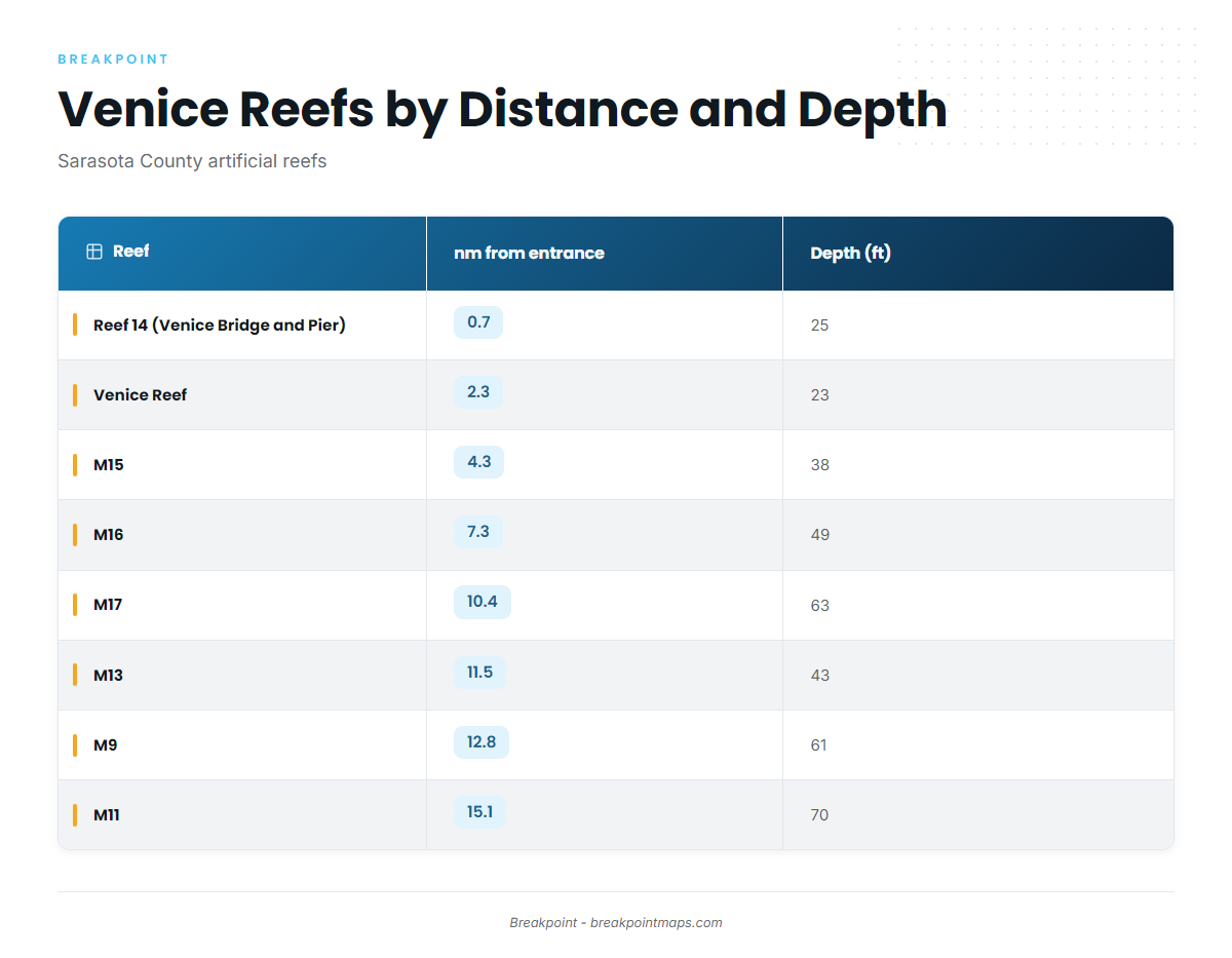
Offshore from Venice, the Sarasota County artificial reef list steps out in distance and depth from the entrance. Inside 5 nautical miles, reefs sit in 23 to 38 feet. From 7 to 11.5 nautical miles, depths run 43 to 63 feet. From 12.8 to 15.1 nautical miles, reefs sit in 61 to 70 feet. Snook Alley is a known spot close in.
| Reef | nm from entrance | Depth (ft) |
|---|---|---|
| Reef 14 (Venice Bridge and Pier) | 0.7 | 25 |
| Venice Reef | 2.3 | 23 |
| M15 | 4.3 | 38 |
| M16 | 7.3 | 49 |
| M17 | 10.4 | 63 |
| M13 | 11.5 | 43 |
| M9 | 12.8 | 61 |
| M10 | 13.7 | – |
| M11 | 15.1 | 70 |
The reef grid and the hard bottom around it hold gag grouper. Seasons, sizes and bag limits for Gulf reef fish change with the season and quota, so check the Florida Fish and Wildlife Conservation Commission (FWC) saltwater regulations before fishing.
Winter
Sharks are the main winter species at Venice. Cold fronts bring strong, gusty winds from fall through spring, and fishing windows tend to fall between fronts. Check VENF1 and the forecast for wind and period before committing to the outer band. Sailfish sit on a long run well past the mapped reefs. See Gulf patterns and general sailfish tactics.
Spring
King mackerel and cobia lead the spring list. Kings can show over the inside and middle reefs. Cobia tend to turn up around structure and cruising rays close in.
Summer
Tarpon, mangrove snapper and blacktip shark fill the summer list. Mangrove snapper tend to stack on reef structure across all 3 bands. Thunderstorms are most likely June through September, in the late afternoon and evening, and often at night at sea, so plan the run home around them.
Red snapper live on deeper hard bottom, and the red snapper guide covers the Gulf. The season is set by quota, so check FWC. Mahi-mahi are bluewater fish, a long run well past the reef grid. See mahi-mahi in the Gulf and the mahi-mahi guide.
Autumn
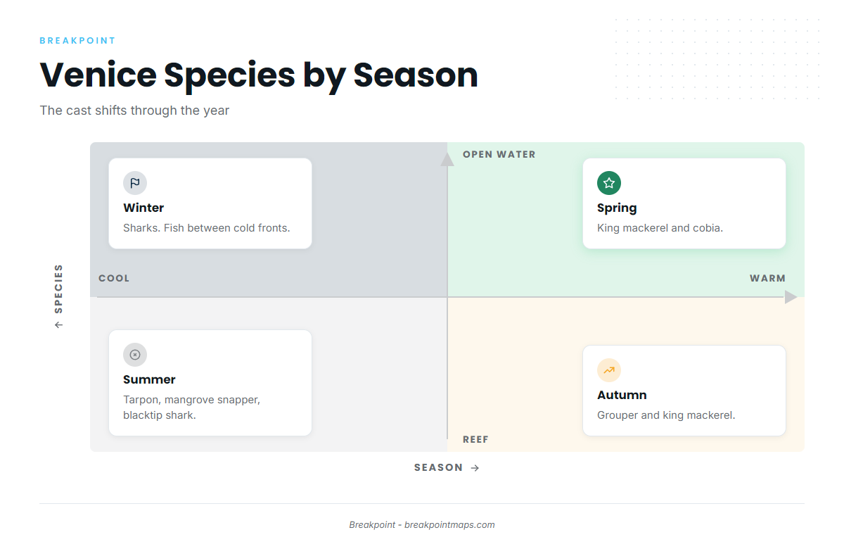
Grouper and king mackerel lead in autumn. Grouper can be worked on the middle and outer bands. Cold fronts begin to return, so check the forecast before each run. Wahoo live in deep water far offshore, a long run well past the mapped reefs. See wahoo in the Gulf and the wahoo guide.
Before the run, check OBS SST, Chlorophyll and Chart Contours over the reef grid to pick which band to fish in Breakpoint. Chart layers are not for navigation.