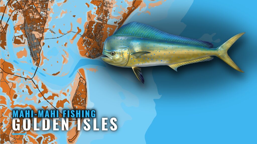
When mahi-mahi are around Golden Isles
Mahi-mahi fishing out of the Golden Isles (Brunswick, St. Simons and Jekyll) means a long run toward the western edge of the Gulf Stream, where boats troll once they arrive. Use this page alongside the Golden Isles port detail for launch and inlet information. It lists the grounds in order from the beach out, then covers how the run is fished.
The Golden Isles visitor bureau describes extended Gulf Stream trips that go "when conditions allow." That phrase is the whole timing story for the run. The official marine forecast decides it, so read wind, wave height and period for your route and make the call from those numbers.
Seasonality and biology are in the mahi-mahi species guide. This page covers the port.
Check these before you commit to the run:
- Wind: the forecast speed and direction over your whole route, not just at the inlet.
- Wave height: the forecast height offshore, in feet.
- Wave period: the seconds between crests, which tells you how the swell will meet your hull.
How far boats run, and where
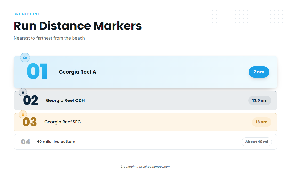
The visitor bureau describes extended offshore trips toward the Gulf Stream, and Southeastern Angling describes runs to its western edge. Neither gives a Gulf Stream mileage, so this page doesn’t print one. The farthest distance marker on the run is the 40 mile live bottom, about 40 miles offshore according to Southeastern Angling. Nearer marks are the artificial reefs at 7, 13.5 and 18 nautical miles, covered in the next section.
Known distances are where fuel and range planning starts. For the regional picture of the Gulf Stream along this coast, see the Atlantic Southeast mahi guide (see also the Atlantic Southeast fishing guide).
Grounds and structure on the run offshore
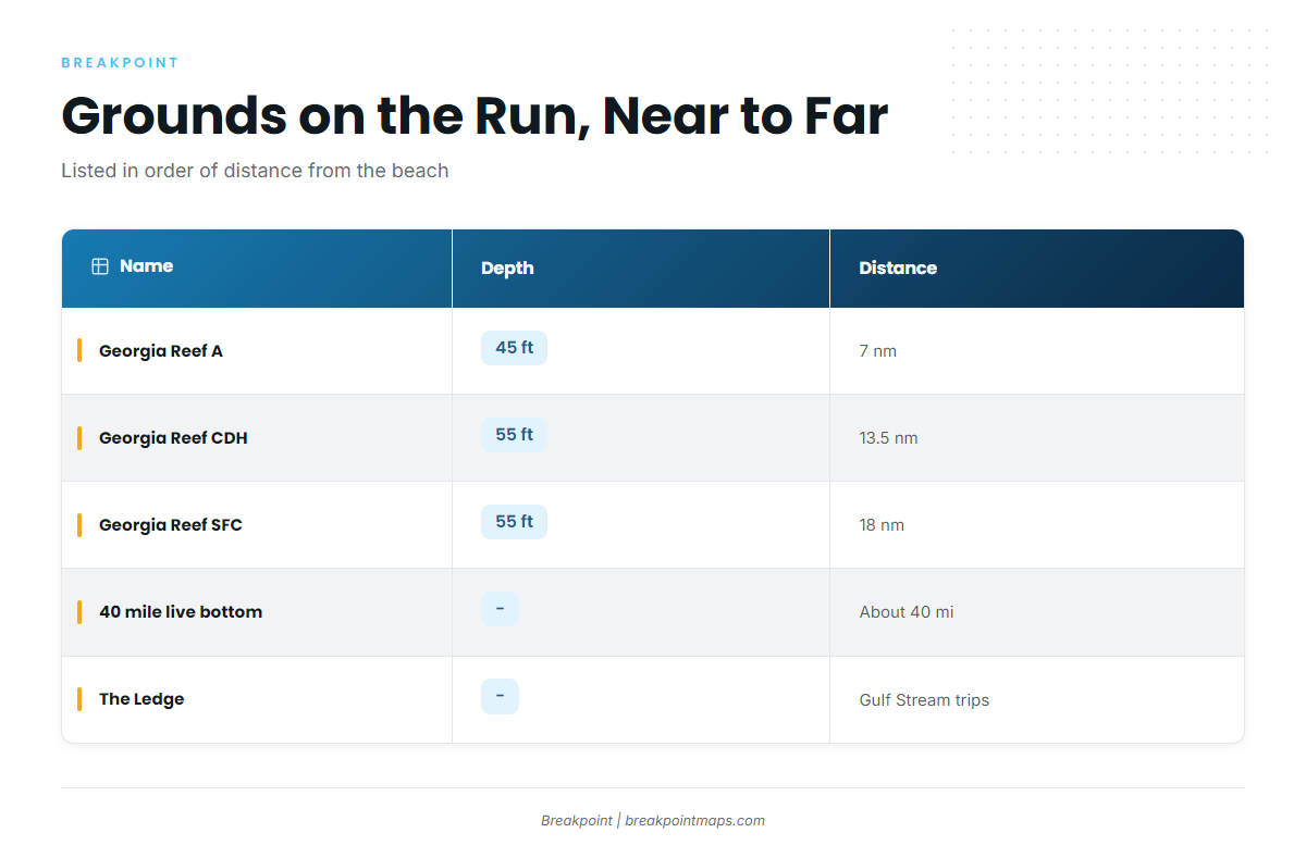
The named grounds below are listed in order of distance from the beach. Georgia Reef A is the nearest, and the Gulf Stream marks sit at the far end.
| Name | Depth | Distance and reference point |
|---|---|---|
| Georgia Reef A | 45 ft | 7 nautical miles east of Little Cumberland Island |
| Georgia Reef CDH (formerly C) | 55 ft | 13.5 nautical miles east of Cumberland Island |
| Georgia Reef SFC (includes Golden Ray propeller and rudder section) | 55 ft | 18 nautical miles east of Little Cumberland Island |
| 40 mile live bottom | About 40 miles offshore (Southeastern Angling) | |
| The Ledge | Offshore on Gulf Stream trips |
The Georgia reefs plot on the Chart Contours layer in the app. Chart layers are not for navigation, so use your official charts to run.
Georgia Reef A
Georgia Reef A sits in 45 ft, 7 nautical miles east of Little Cumberland Island. It is the first named artificial reef on the line offshore.
Georgia Reef CDH
Georgia Reef CDH sits in 55 ft, 13.5 nautical miles east of Cumberland Island. CDH was formerly C, so older numbers and charts may show "C." Its reference point is Cumberland Island rather than Little Cumberland Island.
Georgia Reef SFC and the Golden Ray
Georgia Reef SFC sits in 55 ft, 18 nautical miles east of Little Cumberland Island. It includes the propeller and rudder section of the Golden Ray. The Golden Ray itself is a capsized vessel, partly removed, lying on its port side.
G Reef (HLHA)
"G Reef" is an operator’s name. The state list shows the same reef as HLHA, formerly G. If a captain gives you "G Reef," look for HLHA on the state list.
40 mile live bottom
Southeastern Angling places the 40 mile live bottom about 40 miles offshore. It is the farthest distance marker given on the run toward the Gulf Stream.
The Ledge
Southeastern Angling describes The Ledge as offshore ground on Gulf Stream trips, near the western edge. No coordinates, depth or distance are given for it here.
How mahi-mahi fishing out of Golden Isles is done, and who does it
Trolling is the local method. You run to the grounds and put the spread out, on trips that go when conditions allow. For trolling depth beyond this local note, see the offshore gamefish guides.
On the charter side, Georgia Saltwater Adventures charter lists mahi-mahi. Captain Kevin Dezern is the owner, and Captain Dave Madray also runs trips. Southeastern Angling lists its own Gulf Stream trips as no longer offered.
FAQ about mahi-mahi out of Golden Isles
How far do boats run for mahi-mahi from Golden Isles?
Extended trips run toward the western edge of the Gulf Stream. The farthest given marker is the 40 mile live bottom, about 40 miles offshore according to Southeastern Angling.
What grounds are on the way out?
In order from the beach:
- Georgia Reef A: 45 ft, 7 nautical miles
- Georgia Reef CDH: 55 ft, 13.5 nautical miles
- Georgia Reef SFC: 55 ft, 18 nautical miles
- 40 mile live bottom
- The Ledge
What is G Reef’s state name?
The state list shows it as HLHA, formerly G. "G Reef" is the operator’s name.
What is the Golden Ray’s connection to the reefs?
Its propeller and rudder section is part of Georgia Reef SFC. The rest is a capsized, partly removed vessel lying on its port side.
How is mahi-mahi fished here, and who lists it?
Trolling, on trips that go when conditions allow. Georgia Saltwater Adventures, with Captain Kevin Dezern and Captain Dave Madray, lists mahi-mahi.
Where are the rules?
On the Georgia regulations page and the federal dolphin and wahoo rules page, both linked above. Check them before you fish.