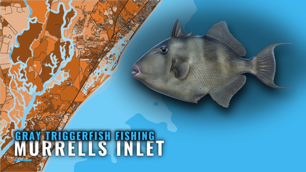
Gray triggerfish fishing out of Murrells Inlet: the 70 to 180 ft band
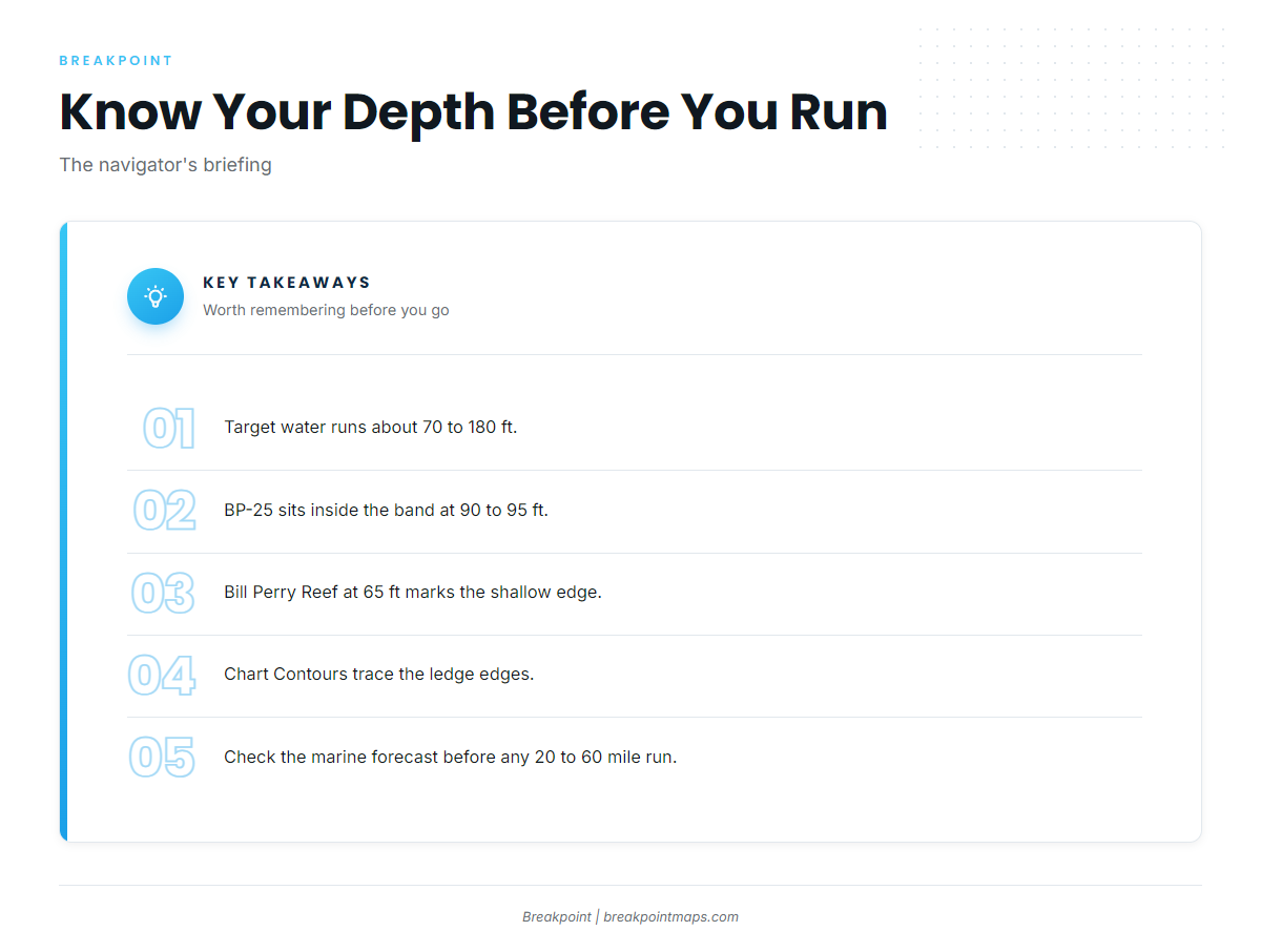
Gray triggerfish fishing out of Murrells Inlet is bottom fishing in roughly 70 to 180 ft of water, over ships, ledges and hard bottom. The run out of Murrells Inlet to that water is long. The grounds below are sorted by where their depths fall against that band, so you can choose a drop before you leave the dock. For the wider coast, see the gray triggerfish fishing in the Atlantic Southeast and the wider Atlantic Southeast guide.
How far the fleet runs
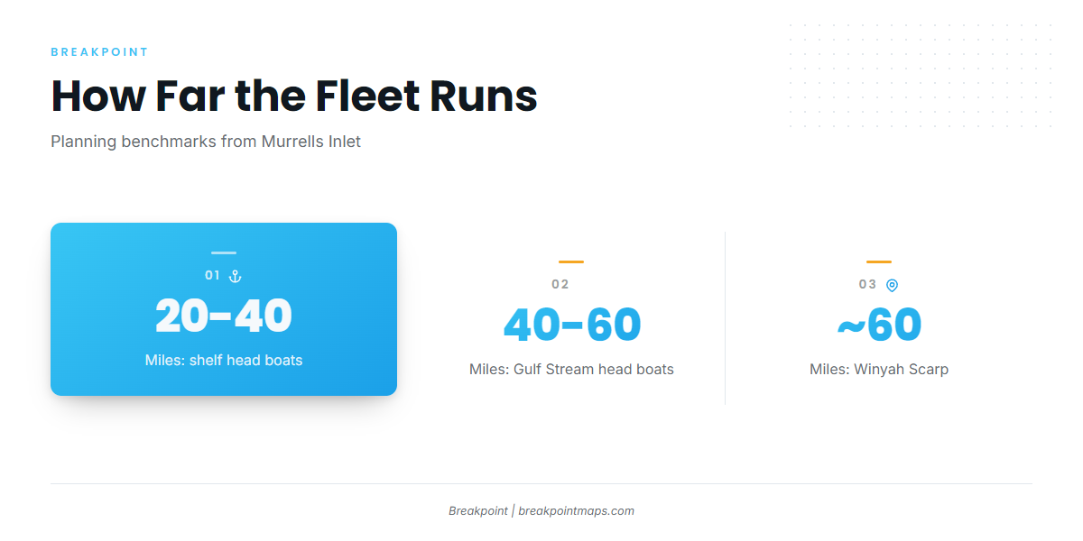
These are the distances the local fleet covers, and they give you a way to gauge your own boat’s range.
- Shelf head boats: 20 to 40 miles.
- Gulf Stream head boats: 40 to 60 miles.
- Winyah Scarp: about 60 miles out.
Before you run
Read the official marine forecast for wind, wave height and wave period before committing to a 20 to 60 mile run. Those numbers should decide whether you go, not the conditions at the dock.
Grounds and structure off Murrells Inlet
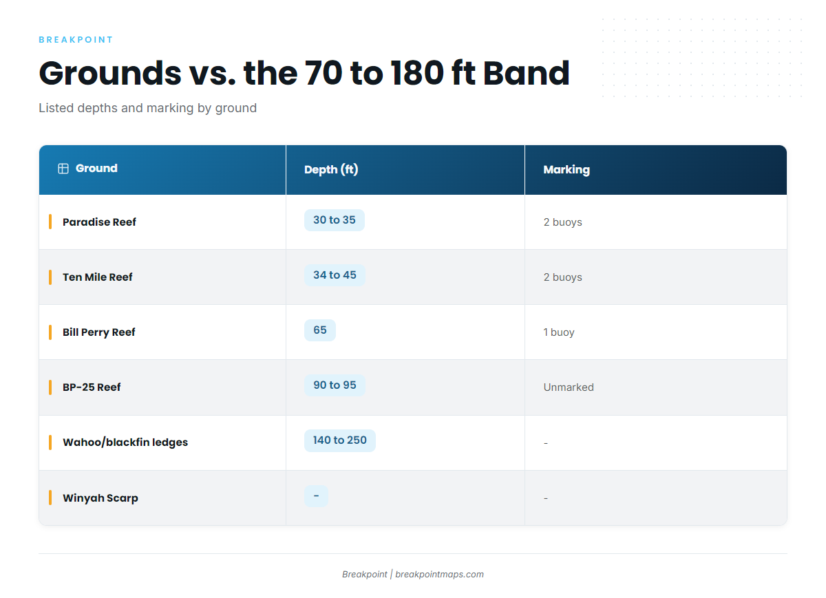
Each named ground is listed with its depth. Three sit inside or overlap the 70 to 180 ft band, one sits at its edge, and three are shallower than it.
| Ground | Depth (ft) | Marking | Notes |
|---|---|---|---|
| Paradise Reef (with H.P. Springs Jr. and other add-on reefs) | 30 to 35 | 2 buoys | Shallow of band |
| Ten Mile Reef | 34 to 45 | 2 buoys | Shallow of band |
| Pawley’s Island Reef | 23 to 35 | 1 buoy | 177 degrees, 5.5 nm from the south jetty |
| Bill Perry Reef | 65 | 1 buoy | Edge of band |
| BP-25 Reef | 90 to 95 | Unmarked | 160′ ship |
| Will Goldfinch Reef | 175′ ship (YO-225), 33 17.005 N / 078 45.372 W | ||
| Winyah Scarp area | Ledge, about 60 miles out | ||
| Nearshore ledges (wahoo and blackfin ledges) | 140 to 250 | Overlaps band |
Inside the band: BP-25 Reef
BP-25 is a 160′ ship in 90 to 95 ft of water. It has no buoy, so you locate it with the chart and the sounder. The Chart Contours layer shows where the 90 ft line runs.
Inside the band: Will Goldfinch Reef (YO-225)
Will Goldfinch Reef is the 175′ ship YO-225 at 33 17.005 N / 078 45.372 W. Chart layers are not for navigation, so confirm the position against your own charts and plotter.
Overlapping the band: the wahoo and blackfin ledges
The nearshore ledges run 140 to 250 ft. Their shallower part falls inside the 70 to 180 ft band, and their deeper part extends past 180 ft. Chart Contours lines trace the ledge edges.
Farther out: Winyah Scarp
Winyah Scarp is a ledge area about 60 miles out, at the outer end of the Gulf Stream head boat range of 40 to 60 miles.
Edge of the band: Bill Perry Reef
Bill Perry Reef sits in 65 ft under 1 buoy, just shallower than the 70 ft start of the band.
Shallow of the band: Paradise, Ten Mile and Pawley’s Island Reefs
Paradise Reef, with H.P. Springs Jr. and other add-on reefs, sits in 30 to 35 ft under 2 buoys. Ten Mile Reef sits in 34 to 45 ft under 2 buoys. Pawley’s Island Reef sits in 23 to 35 ft under 1 buoy, on a bearing of 177 degrees and 5.5 nm from the south jetty.
All three are well shallower than the band. A buoyed reef can be found by sight, while an unmarked ship like BP-25 cannot.
How triggerfish are fished here
The local method is bottom fishing. You drop over the ships and ledge edges listed above, inside the band, and position the boat on the structure rather than on open sand beside it.
For timing, biology and tackle, use the gray triggerfish guide. The same bottom is worked for black sea bass and other reef fish, and that page carries the regional picture.
Who fishes for triggerfish out of this port
These operators list gray triggerfish. Their trip distances show how far you would run your own boat to reach the same water.
Crazy Sister Marina
Crazy Sister runs two head boats, the New Inlet Princess and the 110 ft Crazy Sister. See Crazy Sister’s head boat trips for the lineup. The shelf trips run 20 to 40 miles and the Gulf Stream trips run 40 to 60 miles.
Marlin Quay Marina
Marlin Quay’s fishing charter fleet menu lists the Carolina Fly and the Grand Slam.
Salty Hooker Fishing Charters
Salty Hooker’s offshore trips include 3/4-day and Gulf Stream runs.
Myrtle Beach Sport Fishing
Myrtle Beach Sport Fishing’s trips include a Continental Shelf run. The site describes two boats.
Reel Myrtle Beach Fishing Charters
Captain Matt runs a 32′ center console from Murrells Inlet Marina. The 6-hour trip, 20 to 30 miles out, is for kingfish and black sea bass. It appears on the local charter list but is not a triggerfish run.
FAQ
How far out are the triggerfish grounds from Murrells Inlet?
Shelf head boats run 20 to 40 miles. Gulf Stream head boats run 40 to 60 miles. Winyah Scarp is about 60 miles out.
What depth do you fish for gray triggerfish off Murrells Inlet?
The band is about 70 to 180 ft. BP-25 at 90 to 95 ft and the ledges at 140 to 250 ft overlap it.
Which reef is closest to the depth band?
Bill Perry Reef sits at 65 ft with 1 buoy, at the shallow edge of the band. BP-25 is the first listed ground inside the band.
Is BP-25 marked?
No. It is an unmarked 160′ ship in 90 to 95 ft, found with the chart and the sounder.
Where is Will Goldfinch Reef?
It is the 175′ ship YO-225 at 33 17.005 N / 078 45.372 W. Chart layers are not for navigation.
Do the 6-hour nearshore charters target triggers?
No. Reel Myrtle Beach’s 6-hour trip, 20 to 30 miles out, targets kingfish and black sea bass. The shelf and Gulf Stream trips above are the ones that list triggerfish.