Where boats run out of St. Marys
Spanish mackerel fishing out of St. Marys runs from the jetties at the inlet to artificial reefs 8 nautical miles east of Cumberland Island. This guide works from the inlet outward.
The inlet at St. Marys has a Georgia side and a Florida side. The FA fish haven sits on the Florida side, so some reports come from Florida water, where different rules can apply. The Regulations section covers where to look.
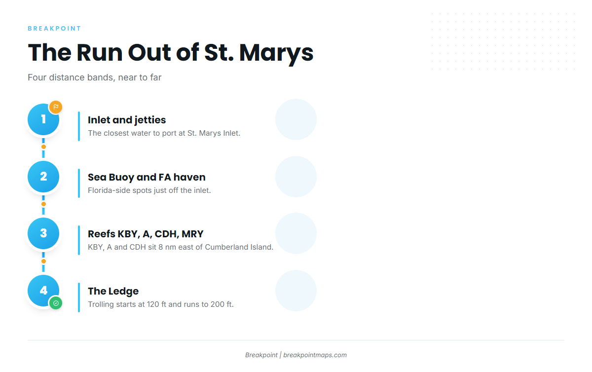
Boats run in four bands, near to far:
- The inlet and the St. Marys jetties, north and south.
- The St. Marys Sea Buoy and the FA fish haven on the Florida side.
- Reefs KBY, A and CDH, 8 nautical miles east of Cumberland Island, plus MRY.
- The Ledge, where trolling starts at 120 ft and runs to 200 ft.
The inlet and the Florida-side spots are the closest water, so anyone trailering in for a weekend can start there.
Grounds and structure off St. Marys
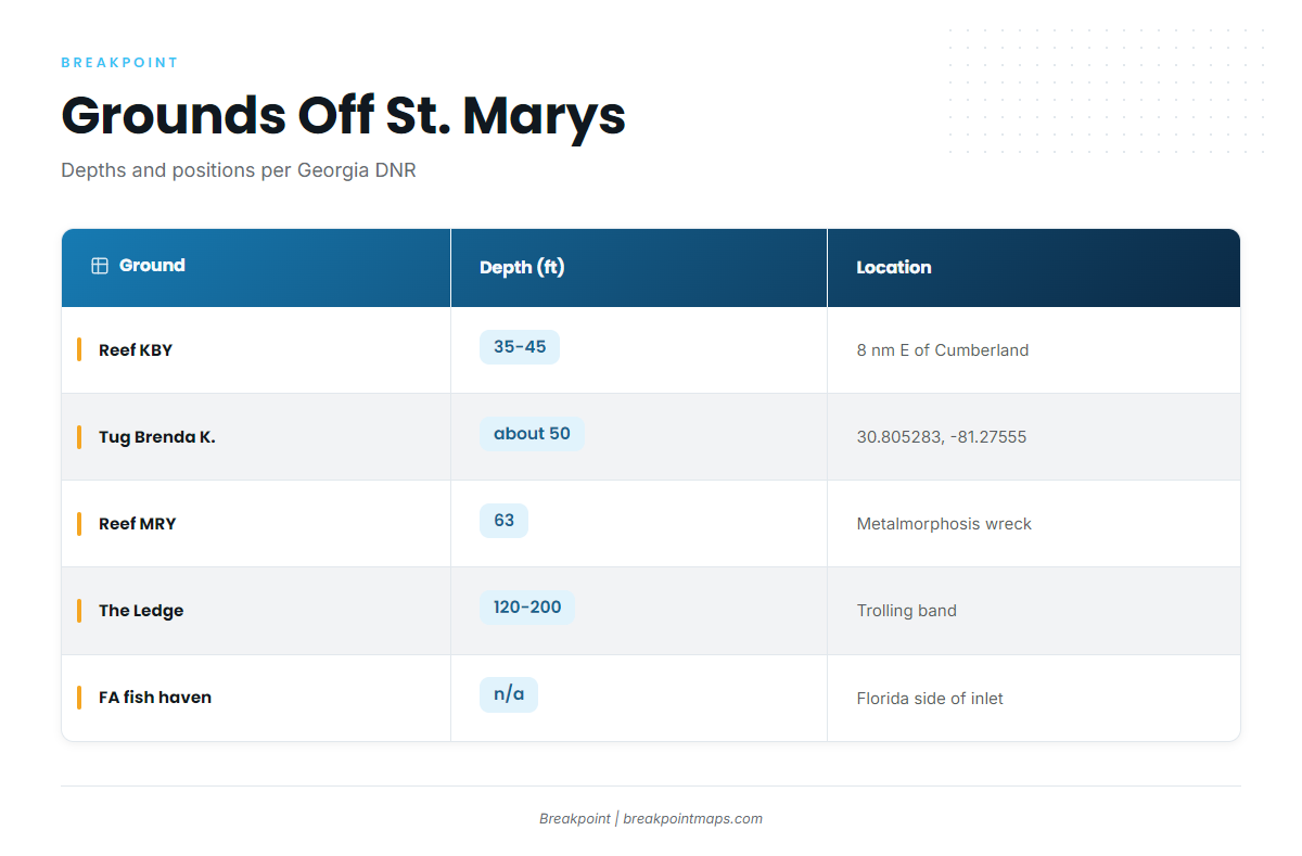
Georgia DNR describes the reefs off Cumberland Island. The table lists each ground with the depth and location note we have for it. A blank depth means no depth is published for that ground.
| Ground | Depth (ft) | Location note |
|---|---|---|
| St. Marys jetties (north and south) | At St. Marys Inlet | |
| St. Marys Sea Buoy | Off the inlet | |
| FA fish haven (live bottom, tug and barge) | Florida side of the inlet | |
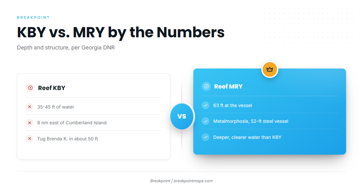
| Reef KBY | 35-45 | 8 nautical miles east of Cumberland Island |
| Tug Brenda K. (at KBY) | about 50 | 30.805283, -81.27555 |
| Reef MRY (Metalmorphosis, 52-ft steel vessel) | 63 at the vessel | Deeper, clearer water than KBY (Georgia DNR) |
| Reefs A and CDH | Listed as nearby reefs on the KBY page | |
| The Ledge / Big Ledge | 120-200 (trolling band) | Continental shelf |
The Brenda K. coordinates load into a plotter or the Breakpoint app as a waypoint. Chart layers are not for navigation.
St. Marys jetties
The north and south jetties at St. Marys Inlet are the closest structure to port and the first ground on every run.
Reef KBY and the Brenda K.
KBY sits in 35-45 ft, 8 nautical miles east of Cumberland Island. The tug Brenda K. lies at KBY in about 50 ft, at 30.805283, -81.27555.
Reef MRY and Metalmorphosis
Metalmorphosis is a 52-ft steel vessel with 63 ft of water at the vessel. Georgia DNR says MRY is deeper, with clearer water, than KBY.
Reefs A and CDH
Reefs A and CDH are listed as nearby reefs on the KBY page. Plan them as stops near KBY.
The Sea Buoy and the FA fish haven
Bait gets jigged at the St. Marys Sea Buoy. The FA fish haven is live bottom plus a tug and barge, on the Florida side of the inlet. The methods section covers how each is used.
The Ledge
The Ledge, or Big Ledge, is the continental shelf. Trolling starts at 120 ft and runs to 200 ft, and Rainbreak runs 12-hour trips there. Treat it as run-distance context: the choice is nearshore reef water at 35-63 ft or the shelf trolling band. If your run becomes an offshore trip, the offshore trolling gamefish guides pick up from there.
When Spanish mackerel are around St. Marys
Local inshore trips from Lang Charters advertise "mackerel" in their titles without naming the species. The listings do not separate Spanish mackerel from king mackerel, so they do not fix a window for either one.
The species guide covers the Spanish mackerel migration and temperature picture. The regional guide has the southeast Georgia and northeast Florida pattern (see also the wider Atlantic Southeast guide). The official species account is NOAA’s Spanish mackerel species profile.
How it is fished locally, and who fishes it
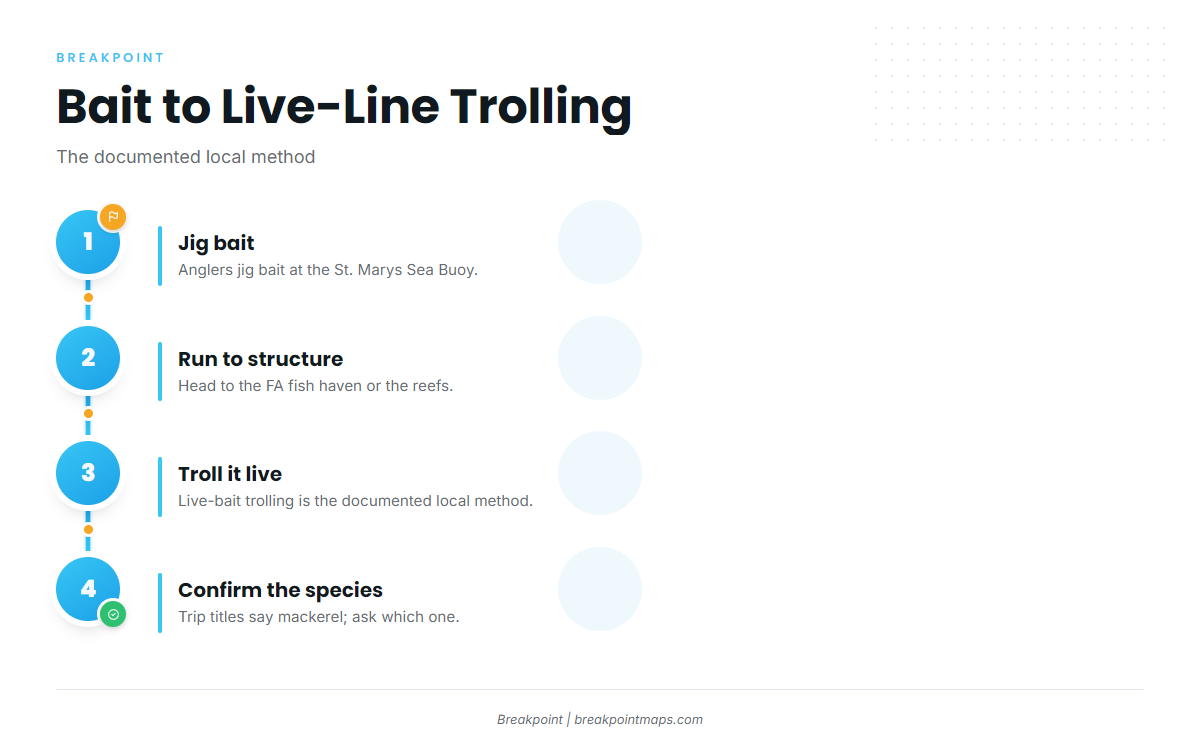
Bait comes first, then the troll.
Jigging bait at the Sea Buoy
Anglers jig bait at the St. Marys Sea Buoy. That bait supplies the live-bait trolling described next.
Live-bait trolling
Live-bait trolling is the documented local method. Reports of it at the FA fish haven come from the Florida side of the inlet, not from a Georgia captain, so the evidence is thin. The same method applies around the reefs.
Who fishes out of St. Marys
Two operators show the range of water this port covers:
- Lang Charters runs inshore trips with "mackerel" in their titles.
- Rainbreak runs 12-hour trips to the Ledge.
FAQ
How far is Reef KBY from St. Marys?
KBY sits 8 nautical miles east of Cumberland Island, in 35-45 ft of water. The tug Brenda K. lies at KBY in about 50 ft, at 30.805283, -81.27555. Load that position as a waypoint before you leave the dock.
Should I fish KBY or MRY?
KBY is 35-45 ft. MRY is 63 ft at Metalmorphosis, and Georgia DNR says MRY has deeper, clearer water than KBY. Neither ground comes with a promise of fish, so the choice is yours.
Where do I get bait?
Anglers jig bait at the St. Marys Sea Buoy, then troll it live at the FA fish haven on the Florida side of the inlet or around the reefs. The Sea Buoy is the first stop before the run.
Does "mackerel" on a St. Marys trip mean Spanish mackerel?
Not necessarily. Local inshore trip titles say "mackerel" without naming the species, and the word can mean king mackerel. Ask the operator which species the trip targets before you book.
Do the Ledge trips target Spanish mackerel?
Rainbreak’s 12-hour trips troll the Ledge at 120 to 200 ft, which is offshore trolling water. The Spanish mackerel grounds on this page are the inlet and the nearshore reefs.
Which state’s rules apply at St. Marys Inlet?
It depends on the side of the line and the distance offshore. The FA fish haven is on the Florida side, and the reefs and the Ledge raise the federal question. Check the agency pages before you fish.