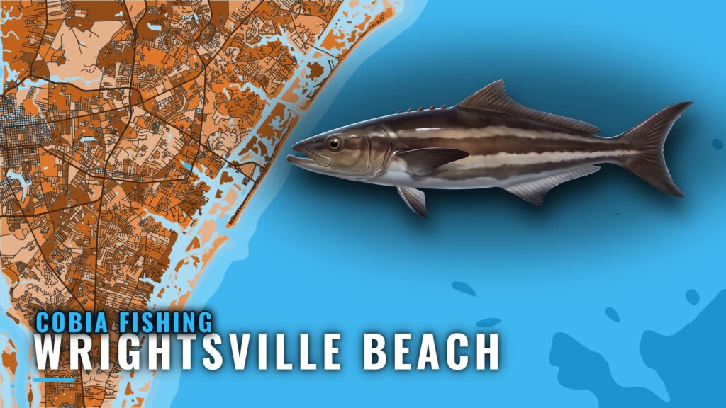
Cobia fishing out of Wrightsville Beach runs May through November. Anglers see cobia nearshore, and crews fishing for grouper 25 to 30 miles out sometimes lure cobia in to their spreads. This page covers when the fish are around, how far boats run, the named grounds, and how local boats fish them. The map for Wrightsville Beach holds the port layers. General cobia biology and tactics are in the general cobia biology and tactics guide; this page covers only this port.
When cobia are around Wrightsville Beach
Southern Run Fishing Charters lists cobia on its 6 and 8-hour trips from May through November, which is the window for this port.
The broader migration is covered in the wider Atlantic southeast run (see also the wider Atlantic Southeast guide). For Wrightsville, plan around May through November and pick one of the two tiers below.
How far boats run
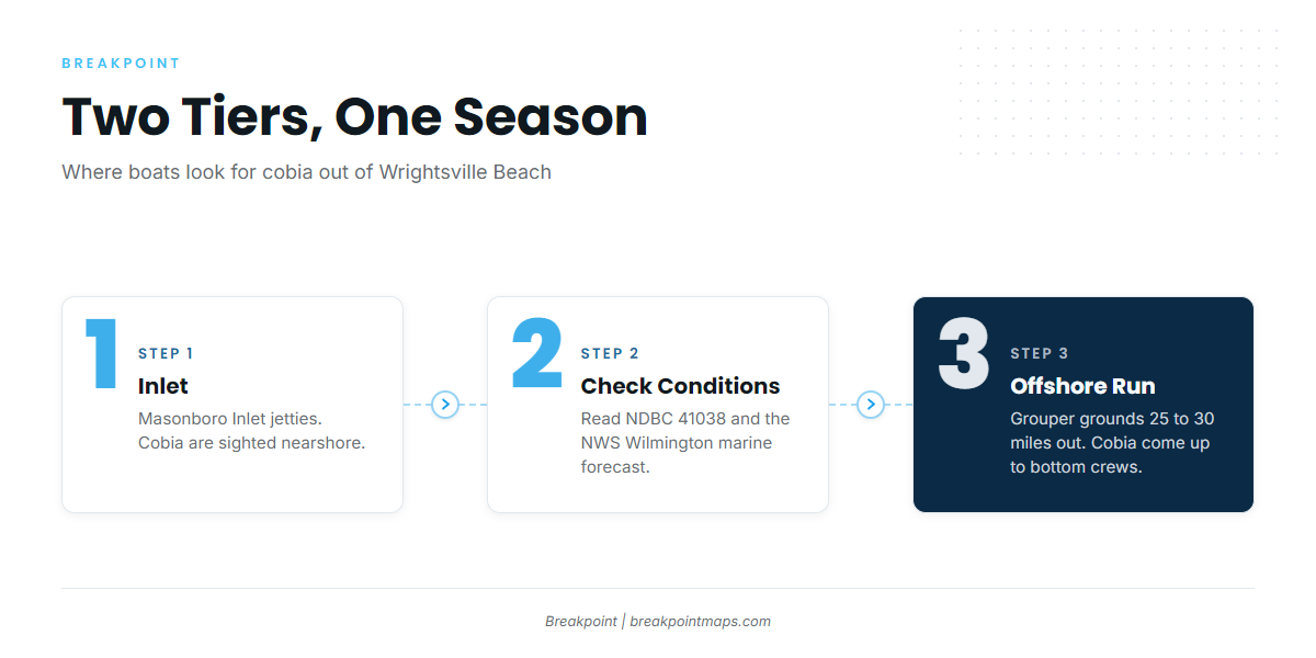
Boats here fish two tiers: nearshore, where cobia are sighted, and the grouper grounds 25 to 30 miles out.
| Tier | Distance | What is reported |
|---|---|---|
| Nearshore | Inside the inlet and near the beach | Cobia sightings |
| Offshore | 25 to 30 miles | Cobia lured in by grouper anglers |
| Southern Run 8-hour trip | About 30 miles | Live baiting over shipwrecks for amberjack and cobia |
Nearshore
Cobia are sighted nearshore. The named structure at the inlet is the Masonboro Inlet jetties, north and south, and they are the place to start if you fish close to the beach.
25 to 30 miles out
Grouper anglers 25 to 30 miles out lure cobia in. Southern Run’s 8-hour trip runs about 30 miles, which gives a reasonable benchmark for fuel and time on the offshore tier. Plan the run around the grouper grounds first, since cobia show up on top of that effort.
Reading conditions at NDBC 41038
The nearest buoy is NDBC 41038, Wrightsville Beach Nearshore (ILM2), at 34.141 N 77.715 W in 18 m of water. It reports wind, wave height, wave period and water temperature.
Check 41038 and the NWS Wilmington marine forecast before the run. Because the buoy sits nearshore, it does not report conditions 25 to 30 miles out, so the forecast has to cover the long run.
Grounds and structure
The grounds run outward from the inlet: jetties first, then the artificial reefs, then the other named grounds.
Masonboro Inlet jetties
Masonboro Inlet has north and south jetties at the inlet itself. They are the first structure on the way out.
Artificial reefs
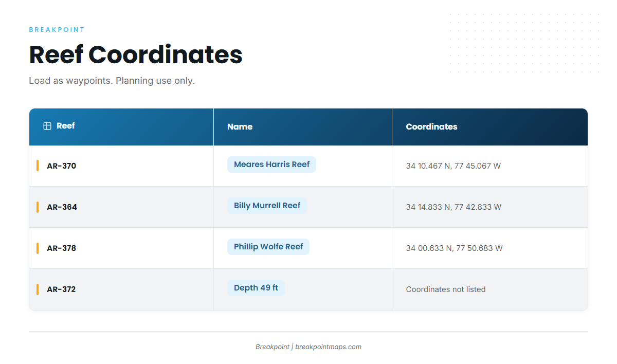
Load these as waypoints:
| Reef | Name | Depth | Coordinates |
|---|---|---|---|
| AR-370 | Meares Harris Reef | 34 10.467 N, 77 45.067 W | |
| AR-364 | Billy Murrell Reef | 34 14.833 N, 77 42.833 W | |
| AR-372 | 49 ft | ||
| AR-378 | Phillip Wolfe Reef | 34 00.633 N, 77 50.683 W |
Use the reef coordinates above as starting points for your own plotting.
Other named grounds
Schoolhouse, Dredge Wreck Reef and 10-Mile Boxcars are named local grounds.
Coordinates and chart contours are for planning, not navigation.
How cobia are fished here and who fishes them
Methods follow the structure. The offshore fishing happens on wrecks and the grouper grounds.
Live baiting over wrecks
Southern Run’s 8-hour trip, about 30 miles out, uses live baiting over shipwrecks for amberjack and cobia. The wreck is the target and live bait is the method.
Cobia on the grouper grounds
Cobia are lured in by grouper anglers. A bottom crew 25 to 30 miles out should keep a live bait ready in case a fish comes up. For amberjack and grouper, see the coastal and offshore gamefish guides.
Charters that list cobia
Southern Run Fishing Charters, Captain Ben Morris, lists cobia on its 6 and 8-hour trips.
FAQ cobia fishing out of Wrightsville Beach
When is cobia season at Wrightsville Beach?
May through November, per Southern Run’s listing on its 6 and 8-hour trips. Use that as the planning window, then choose between the nearshore and offshore tiers.
How far do boats run for cobia?
Nearshore for sightings, or 25 to 30 miles to the grouper grounds. Southern Run’s 8-hour trip is about 30 miles, a reasonable benchmark for fuel and time.
Which reefs have published coordinates?
AR-370 Meares Harris Reef (34 10.467 N, 77 45.067 W), AR-364 Billy Murrell Reef (34 14.833 N, 77 42.833 W) and AR-378 Phillip Wolfe Reef (34 00.633 N, 77 50.683 W). AR-372 is listed at 49 ft. Coordinates are for planning, not navigation.
What buoy should I check?
NDBC 41038, Wrightsville Beach Nearshore (ILM2), 34.141 N 77.715 W, in 18 m of water. Pair it with the official marine forecast, since the buoy sits nearshore and does not read conditions 25 to 30 miles out.
Who runs cobia trips from this port?
Southern Run Fishing Charters, Captain Ben Morris. Its listed method is live baiting over shipwrecks for amberjack and cobia on 8-hour trips, about 30 miles out.