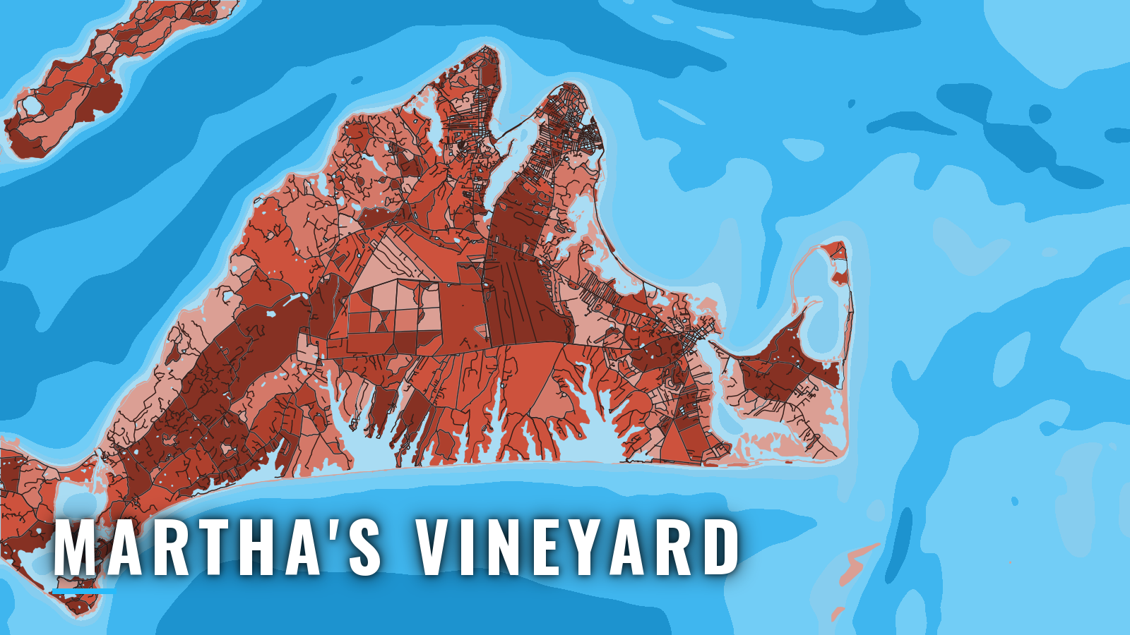

About Martha’s Vineyard
Martha’s Vineyard has four harbors facing different water. Vineyard Haven, Oak Bluffs and Edgartown open to Vineyard Sound and Nantucket Sound. Menemsha opens through a jettied creek onto Menemsha Bight at the west end, with Rhode Island Sound beyond. Anyone running their own boat should read the island before leaving the dock. It sits in the same southern New England water covered in our northeast Atlantic fishing guide.
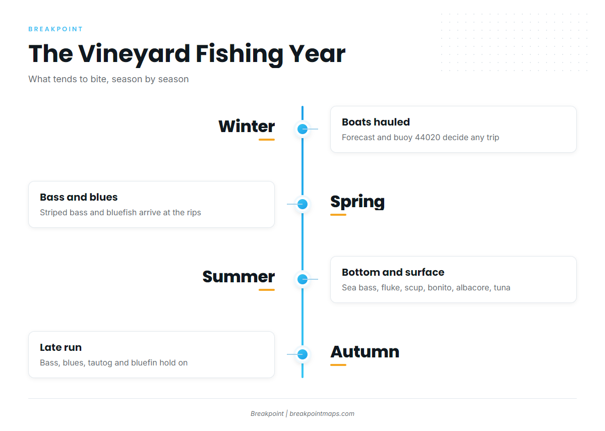
Offshore fishing here starts with striped bass and bluefish in spring. Summer adds black sea bass, fluke, scup, bonito, false albacore, and offshore bluefin and yellowfin tuna, with mahi-mahi and white marlin in warm water. Autumn brings bass, blues, bonito, false albacore, tautog and bluefin. Most of the action centers on the tide rips around Wasque and Gay Head. Size, bag and season rules are on our Massachusetts page.
This guide covers where to launch, how each entrance tends to behave, and what the grounds offer through the year.
Access and navigation
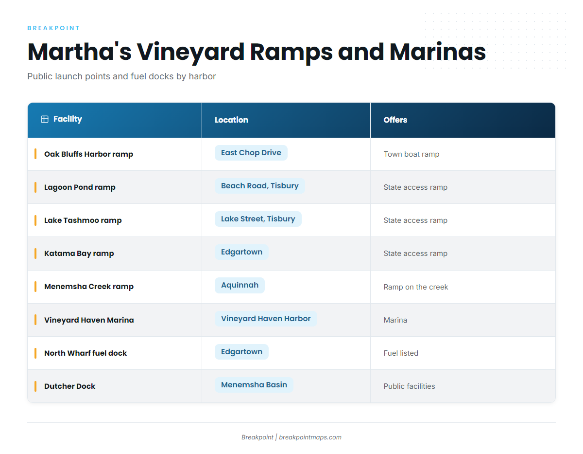
The public ramps below come from the state islands access guide.
- Oak Bluffs Harbor ramp (East Chop Drive) – town boat ramp, Oak Bluffs
- Lagoon Pond ramp (Beach Road, Tisbury) – state boating-access ramp
- Lake Tashmoo ramp (Lake Street, Tisbury) – state boating-access ramp on the Vineyard Sound side
- Katama Bay ramp (Edgartown) – state boating-access ramp, east end
- Menemsha Creek ramp (Aquinnah) – ramp on the creek, west end
- Vineyard Haven Marina – marina in Vineyard Haven Harbor
- North Wharf fuel dock, Edgartown – fuel listed, run by the Edgartown Harbormaster’s Department
- Oak Bluffs Harbor town wharf – fuel listed
- Dutcher Dock, Menemsha Basin – public facilities
Entrances and approaches
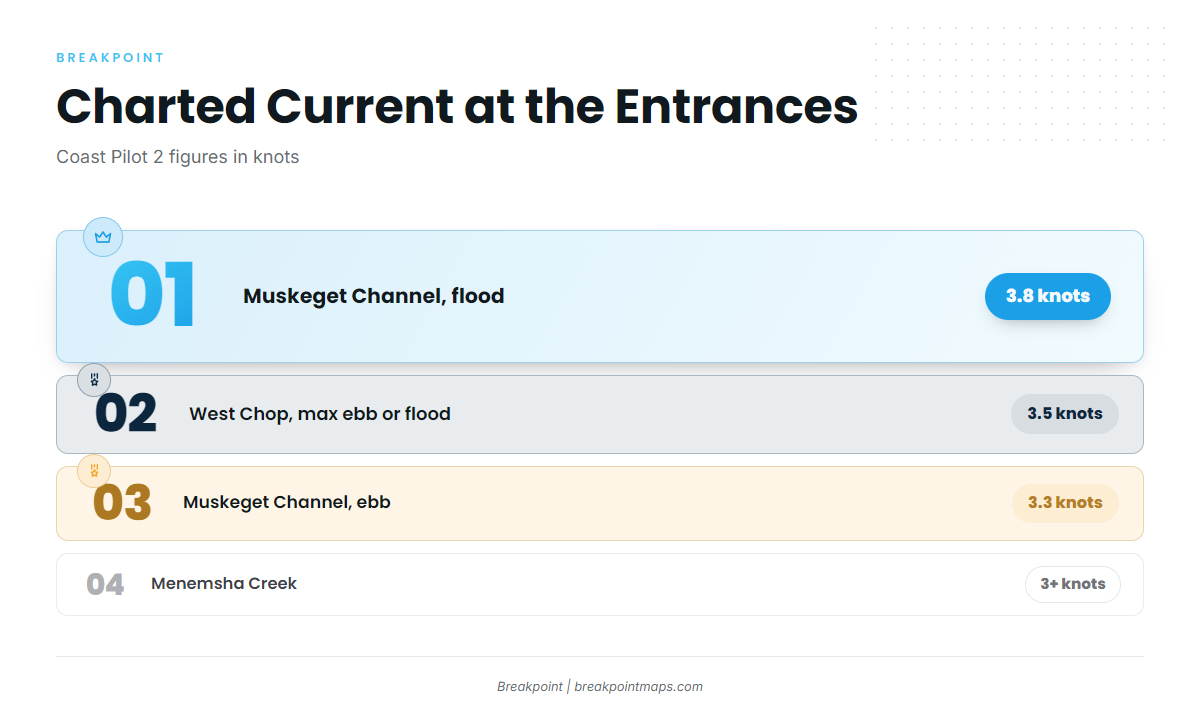
Most of the numbers below come from Coast Pilot 2, Chapter 5. Chapter 4 covers Edgartown, Oak Bluffs and Nantucket Sound.
- Vineyard Haven (East Chop to West Chop): Current off West Chop runs about 3.5 knots at maximum ebb or flood. Wind against it can build a steep chop. In the entrance, the ebb tends to set westward onto the ledges east and north of West Chop.
- Oak Bluffs: The entrance is a breakwater gap onto Nantucket Sound.
- Edgartown Harbor: A channel entrance serving the east end.
- Lake Tashmoo and Lagoon Pond: Both are inlet entrances, and an inlet can change with weather.
- Menemsha Creek: Current through the entrance is estimated at 3 knots or more. Slack is reported about 45 minutes after local high and low water. The creek channel south of Menemsha Basin tends to shoal quickly after dredging.
- Wasque and Muskeget Channel: Wasque Shoal extends south of Wasque Point and dries about 2 miles out, rising abruptly from deep water. Muskeget Channel current runs 3.8 knots on the flood and 3.3 knots on the ebb about 1.5 miles east of the point.
- Gay Head, Nomans Land and Squibnocket: Devils Bridge reef extends 0.8 mile northwest of Gay Head, with 2 feet about 0.4 mile out. A danger zone surrounds Nomans Land. Lone Rock (8 feet) and Old Man (4 feet) lie between Nomans Land and the island. Shoal water reaches 0.5 mile south of Squibnocket Point.
The shoals around Wasque and Muskeget move between surveys, so the chart may lag the bottom.
Alternative approaches
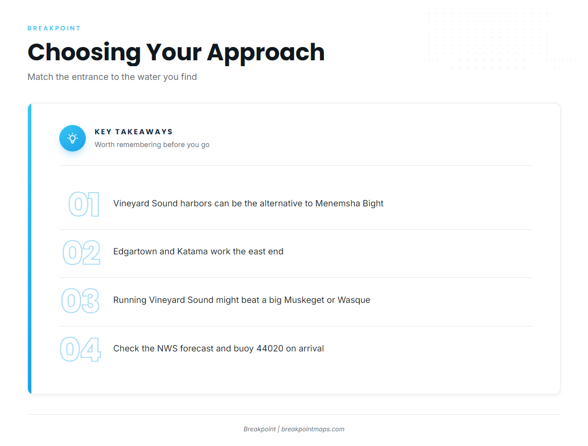
When the Menemsha Bight side is exposed, the Vineyard Sound harbors, Vineyard Haven and Lake Tashmoo, can serve as the alternative. Edgartown and Katama Bay work the east end, and Oak Bluffs tends to be the shorter run to Cape Pogue. If Muskeget or Wasque looks big, running around through Vineyard Sound rather than the south side might be the better choice for reaching Gay Head and Squibnocket.
Check the NWS coastal waters forecast, which includes the Vineyard Sound and Nantucket Sound zones. NDBC station 44020, the Nantucket Sound buoy, reports current conditions on the water.
Look at the water when you arrive and compare it with the official forecast. If it looks bigger than you want, switch approaches.
Fishing conditions
Boat anglers on the island work a short list of grounds. Wasque Shoals sits at the end of the shoal that dries about 2 miles out, where the Muskeget and Wasque currents stack water against the bottom. The rips off Gay Head Cliffs form where current runs over the Devils Bridge reef. Middle Ground lies near West Chop, in the current that runs about 3.5 knots through the Vineyard Haven entrance. Lucas Shoals is a bank in Vineyard Sound, and Squibnocket sits at the shoal water south of its point.
OBS SST and Chlorophyll layers show where the warm, clean water sits before a run south. Chart layers are not for navigation.
Rules and permits change by season, so check the MassDMF saltwater fishing regulations before you fish. Every angler 16 and older needs a Massachusetts saltwater permit.
Winter
Most boats are hauled. The forecast and buoy 44020 decide whether a trip goes at all. The rules still apply, so carry your permit and check the agency page before you leave the dock.
Spring
Striped bass and bluefish arrive first. The striped bass fishing guide explains how they use rips and edges. Bluefish tend to show up in the same water, so the rips and Middle Ground are the places to start looking.
Summer
Summer is the widest season on the island. Black sea bass, fluke and scup work the bottom on Middle Ground and Lucas Shoals, and our black sea bass fishing guide covers the structure they hold on. Bonito and false albacore join the bass and blues along the rips.
Offshore, the bluefin tuna fishing guide covers the biggest target. Yellowfin tuna can show up in warm water, and our yellowfin tuna guide and notes on yellowfin in the northeast cover when and where. Mahi-mahi and white marlin can appear when the water warms.
Boats running farther toward the shelf can read up on yellowfin and bigeye in our bigeye tuna guide and its northeast bigeye notes.
Autumn
Striped bass, bluefish, bonito and false albacore carry the season along the rips and shoals. Tautog is the late-season bottom option. Bluefin hold into fall, and bluefin across the northeast shows how that fits the wider region. Fall water changes fast, so check the water, the forecast and the buoy again before every run.